Subject: North Carolina & South Carolina
Period: 1788 (circa)
Publication: The History of Rise, Progress and Establishment of the…United States
Color: Hand Color
Size:
14.3 x 13.7 inches
36.3 x 34.8 cm
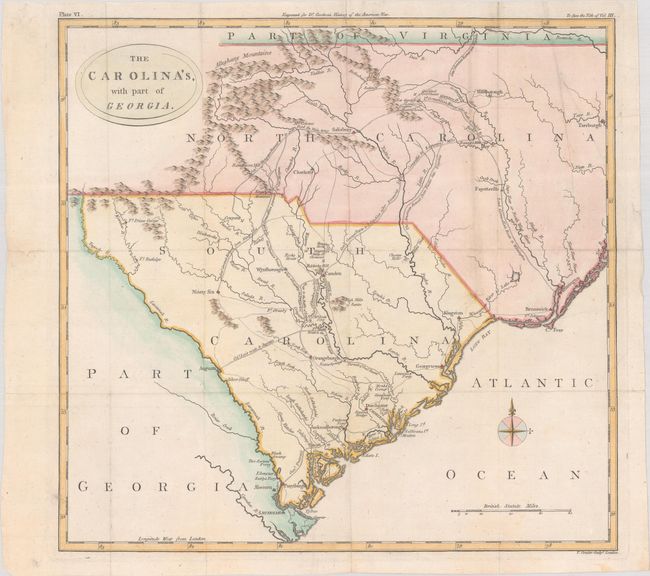
An uncommon map of the Carolinas showing the routes of British and American forces during the Revolutionary War. It illustrates the routes of pursuit and retreat of the troops of Cornwallis, Greene, Lee, and Stuart. The map shows forts, towns, ferry crossings, and battle sites. The topography is simple, and the Appalachians are referred to as the Alleghany Mountains, a term that was frequently used at this time for the whole range from Pennsylvania south to the Carolinas. Published in William Gordon's The History of Rise, Progress and Establishment of the Independence of the United States.
References:
Condition: A
Issued folding, now flat, with a small chip in the neatline at top left that has been repaired on verso with archival tape. There are short splits along the folds and at the fold intersections that have been closed on verso with archival materials.