Subject: North America
Period: 1850 (circa)
Publication: Berghaus’ Vollstandiger Hand-Atlas...
Color: Hand Color
Size:
16.1 x 12.2 inches
40.9 x 31 cm
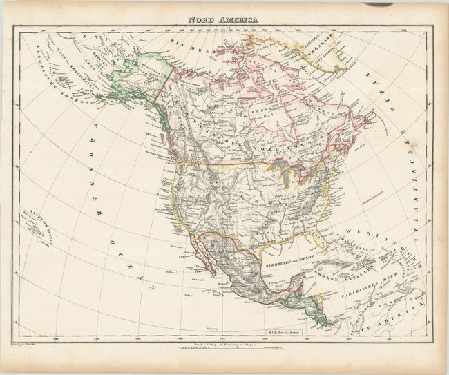
This map reflects most of the United States boundaries as we know them today, with the exception of the Southwest border which still follows the Gila River (pre-Gadsden Purchase). In California, Helvetia and Benicia are named near the recent gold discoveries, and a Mormon Fort is located on the shores of the Great Salt Lake. Alaska is named Russisches Nord America. Includes good detail of topography, river systems, forts, settlements, and more. The map extends to show all of the West Indies and the Sandwich Islands.
References:
Condition: B+
Contemporary outline color with some minor foxing in the image and light toning along the sheet edges.