Subject: Newfoundland, Canada
Period: 1748 (circa)
Publication: The English Pilot, The Fourth Book
Color: Black & White
Size:
10.4 x 12.5 inches
26.4 x 31.8 cm
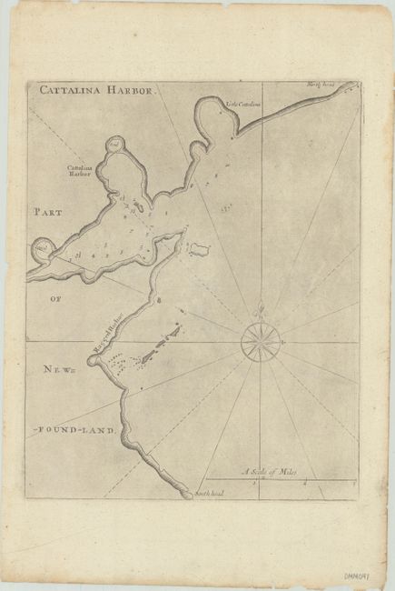
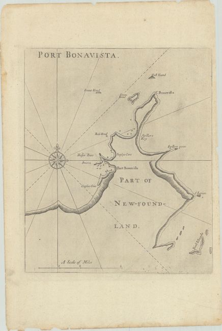
This very scarce sheet includes two charts printed on both sides of the sheet: Catalina Harbor and Port Bonavista along the eastern coast of Newfoundland. Each chart includes a large compass rose and navigational information, such as depth soundings, rocks, and shoals. The sheet is from the important first English sea-atlas of American waters. br>
John Seller was a pioneering British publisher of nautical charts and one of the most important figures in the early history of British cartography. Seller's shop, located near the Tower of London in Wapping, became a gathering place for seamen arriving with the latest news of distant places such as the West Indies and provided Seller with information critical to his nautical chart business. In addition to sea charts, he produced a vast array of cartographic material, the first to rival the large Dutch firms such as Blaeu and Jansson. Seller was appointed Royal Hydrographer by Charles II in 1671, and also served under James II and William III. Unfortunately his business was built on a shaky foundation and though he made several attempts to avoid bankruptcy including a consortium partnership with other cartographers such as William Fisher and John Thornton, he was ultimately unsuccessful. The first full edition of The English Pilot was published by Thornton and Fisher in 1689, with later editions by Thornton and Richard Mount in 1698 and 1706, as well as by Mount and Page between 1707 and the end of the 18th century.
References: Shirley (BL Atlases) M.THOR-2a #6.1 & #6.2.
Condition: A
There are small chips, toning, and soiling along the edges of the sheet.