Subject: Colonial North America
Period: 1772 (circa)
Publication:
Color: Hand Color
Size:
23 x 17.9 inches
58.4 x 45.5 cm
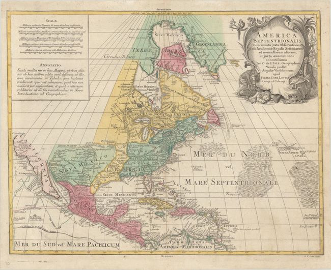
This attractive map is Lotter's version of Guillaume Delisle's foundation map of North America (1700). The Great Lakes are based on the Coronelli model showing the French strong points at Tadousac, Quebec, Fort Sorel, Montreal and Fort Frontenac. The English settlements are confined east of the Mississippi and Illinois Rivers and include all the land around both lakes Erie and Ontario. French Louisiana is comprised of a narrow strip between the Mississippi and New Mexico, but stretches south to include most of present-day Texas. Numerous tracks in the Pacific show the routes of different voyages. The Sargasso Sea is graphically shown in the Atlantic. The most interesting aspect of the map is the region of California. Delisle was the first cartographer to revert to a peninsula form for California. Lotter follows that here, but engraved the map with a small gap at the head of the Gulf of California, thus leaving the possibility still open for the island theory. The large cartouche features a Native American and a ship's captain.
References: Sellers & Van Ee #126; cf. Tooley (America) #34, p. 19.
Condition: A
On watermarked paper with minor soiling and a professionally repaired separation along the lower centerfold.