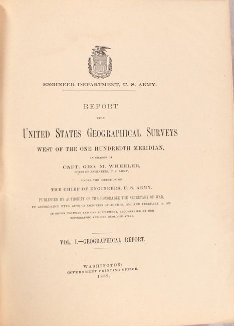
Subject: Exploration & Surveys
Period: 1889 (published)
Publication:
Color: Printed Color
Size:
9.3 x 11.9 inches
23.6 x 30.2 cm
This is the complete Volume I (Geographical Report) of Wheeler's final Survey West of the 100th Meridian dated 1889. While the work was completed between 1871-79, this final report was not released until nearly a decade later. Its primary purpose was to survey the region for possible wagon roads and document the natural resources in the region. It features the following 3 folding maps:
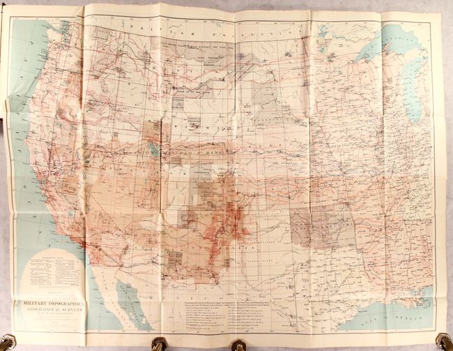
Sketch Indicating the Advancement of the Surveys of the Public Lands and the Military Topographical and Geological Surveys West of the Mississippi, dated 1879 (44.3 x 32.5"). Beautifully lithographed in four colors with impressive detail throughout. The map locates more than 130 forts and camps (many flying tiny American flags), nearly 70 Indian reservations, the routes of dozens of early explorers, completed and projected railroads with their land grants, and dozens of Spanish land grants noted. Survey details plotted include base lines, meridians and townships. Wheeler's surveying efforts are shown as shaded regions. Map consists of four joined sheets.
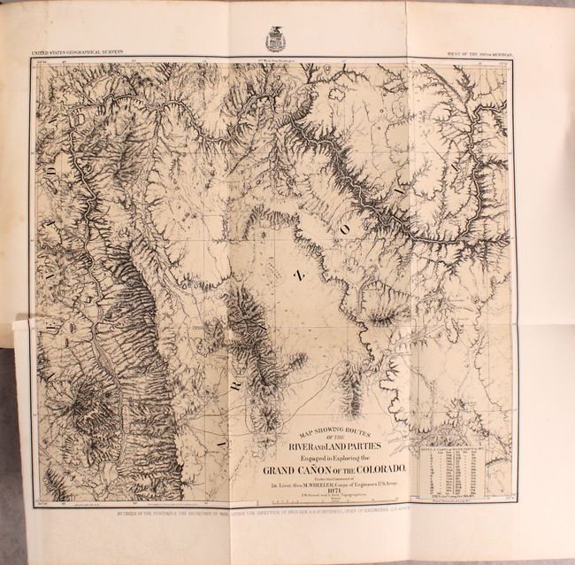
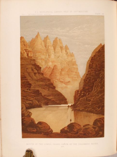
Map Showing Routes of the River and Land Parties Engaged in Exploring the Grand Canon of the Colorado, dated 1871 (16.3 x 15"). This is the map of Wheeler's epic journey in 1871 up the Colorado River from Camp Mohave (near Needles, California) to Diamond Creek. First published in 1878, it shows the course of the Colorado River from the California line to about midway up the Grand Canyon. Disaster, Portage, Castaway, Cascade, Winding, Roaring, and Long Rapids, Vernal Falls, the 1871 Rendezvous, and more are located. The routes of several prior expeditions are noted including those of Whipple, Sitgreaves, Ives, and Wheeler in 1869. A table lists the dates and camps of the river party, each keyed to the map. Detailed geographic information makes this a valuable record of western exploration. This is a single tint lithographed map printed by the Graphic Co. Photo-Lith. 39 & 41 Park Place, N.Y. The map was prepared by Weyss, Thompson & Lang.
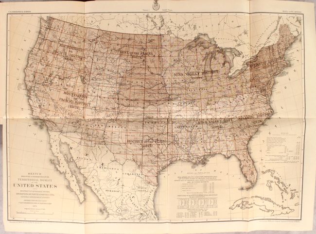
Sketch Indicating a Distribution of the Territorial Domain of the United States into Districts Favorable to the Operations of Parties Prosecuting General Government Surveys…, dated 1879 (28 x 20"). This map is an effort by Wheeler to set out a systematic plan for the scientific mapping and survey of the country. It shows Wheeler's comprehensive plan, proposed in the report, for surveying the entire U.S. in eight districts in 210 rectangular grids, applying the same scientific standard throughout. In fact, this is the same method Wheeler used in his earlier western surveys. The underlying map has excellent topographic and political detail. A surprisingly handsome and important map in the history of the surveying of the United States.
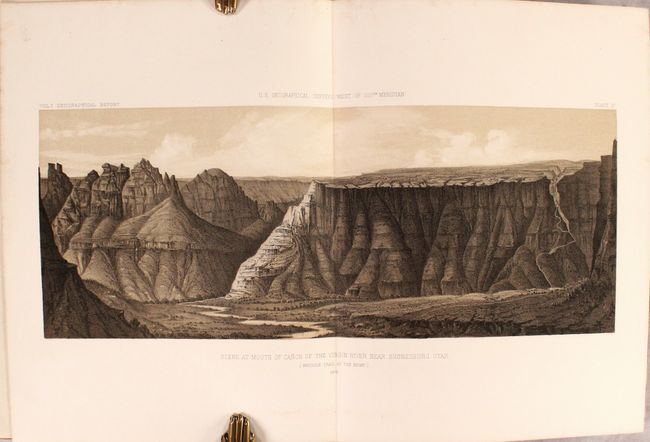
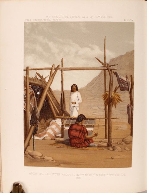
In addition to the large folding maps are 38 plates (several double-page, a few in color) including many attractive views, depictions of natives, and historical maps of North America by the likes of Ortelius, Hondius, Senex and Jeffrys. 780 pages. Hardbound in maroon cloth covered boards with gilt title on spine.
References: Wheat (TMW) #1292; Cohen pp. 192-194.
Condition: B+
The folding maps are very good to near fine with short binding tears at left that just enter the image. Plates and text are mostly clean and bright with an occasional spot of foxing. The binding is somewhat loose with two plates separated from the block. Back hinge is starting and the covers are moderately worn.