Subject: Geography Books
Period: 1674 (published)
Publication:
Color: Black & White
Size:
9.3 x 13.9 inches
23.6 x 35.3 cm
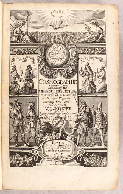
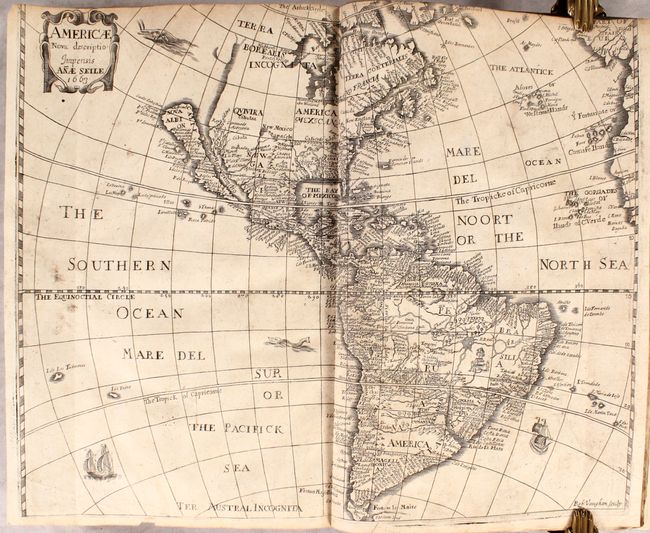
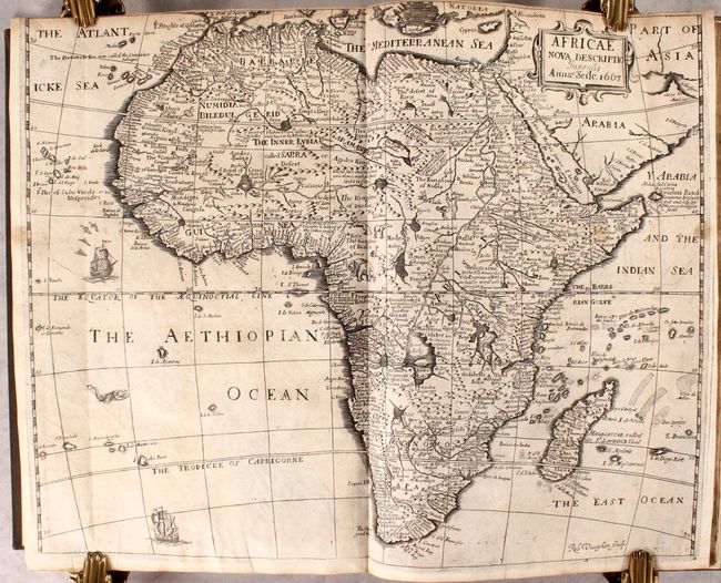
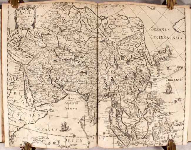
This comprehensive geography book is an expanded version of Peter Heylin's earlier work entitled Microcosmus. The volume is divided into four parts, with parts one and two focusing on Europe (529 pages), part three covering Asia (230 pages), and part four exploring Africa and America (162 pages). The text is augmented by four maps of the continents by Anae Seile, who based her maps on her husband Henry's earlier maps from the 1652 edition. Seile's maps are some of a select few published exclusively by a woman, with her own imprint. The maps include:
Americae Nova Descriptio (16.3 x 13.2"). This map is based on the work of Abraham Goos for John Speed's atlas. It depicts California as an Island, no Great Lakes, and a faint allusion to the northwest coast of North America. On the east coast Maryland, No: Belgium, and Long Ile are named. Annae's map is very similar to Henry's earlier map, although the nomenclature of the Delaware River, Carolina and several places on the west coast have been changed. References: Burden #379; McLaughlin #35; Tooley (America) p.115, #12.
Africae Nova Descriptio (16.6 x 13.3"). This map is a close copy of John Speed's map of the continent from 1626, including many of the decorative elements. The Nile is shown with its origin in the vicinity of the Congo and conforms to the Ptolemaic concept of rivers from Lake Zaire and Lake Zaflan joining to form the mighty river. The course of the Niger River is incorrectly shown and there are many fictitious lakes in Central Africa. Robert Vaughan's signature appears at lower right. References: Betz #100; cf. Norwich #36.
Asia Descriptio Nova (17.3 x 13.4"). The outline of the continent follows the Mercator-Hondius model with a great expanse of water between a truncated Asia and North America, and a very elongated Korean peninsula. Many place names graphically depicting the extent of European knowledge throughout Asia and particularly in the Philippines and East Indies. In the interior of China, the Great Wall is graphically depicted, along with an elephant and the fictitious Chiamay Lacus. The coastline of Java that is shown suggests that it is quite a bit larger than it is, and New Guinea and the Moluccas are shown as a confused group of islands. The map is adorned with two sailing ships and a decorative cartouche. Reference: Yeo #55.
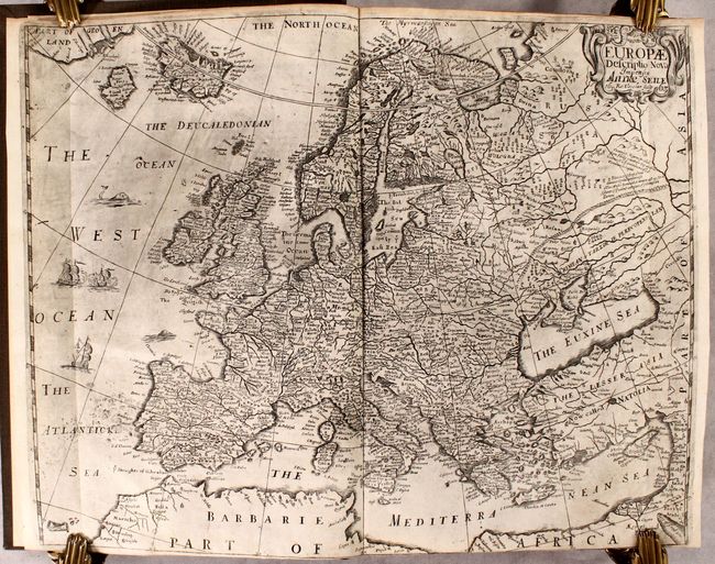
Europae Descriptio Nova (16.3 x 13.2"). This map covers all of Europe in great detail and includes Iceland and the mythical island of Frisland. This non-existent island led to considerable confusion in the mapping of Greenland and Baffin Island in the following centuries. The starkly mapped region of Russia includes some interesting notations. A sea battle, sea monsters and a decorative title cartouche make this an attractive map.
921 pages of English text along with decorative title page, notes to the reader, dedication, introduction, and index. Rebound in quarter faux leather over cloth boards.
References:
Condition: B+
The maps are very good to near fine with some light toning, minor soiling, and a bit of printer's ink residue. The map of America is trimmed to just inside the border at top (by the binder) and has a tiny chip in the bottom blank margin, just touching the border. The map of Africa is trimmed close to the border at top (also as issued). The text is mostly clean and bright with occasional light toning or a spot of foxing. Modern binding is near fine with minor shelf wear.