Subject: Atlases
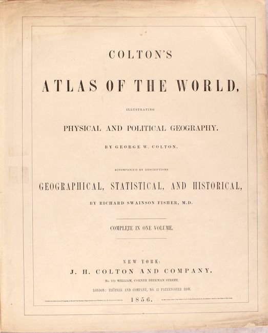
Period: 1856 (published)
Publication:
Color: Hand Color
Size:
15.5 x 18.5 inches
39.4 x 47 cm
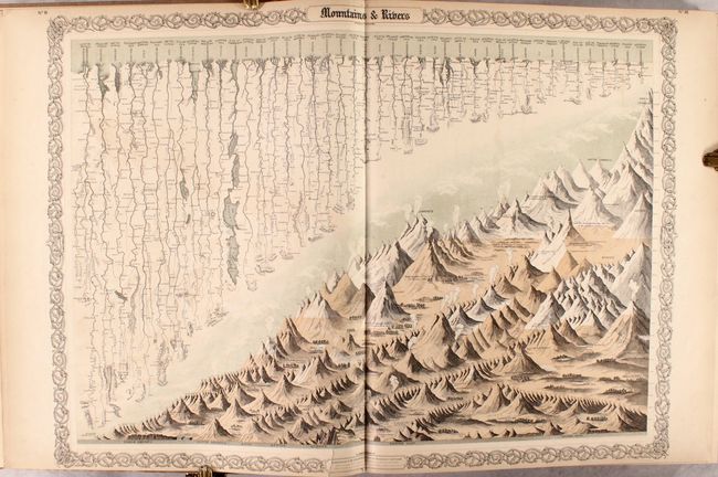
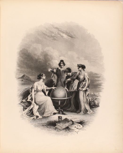
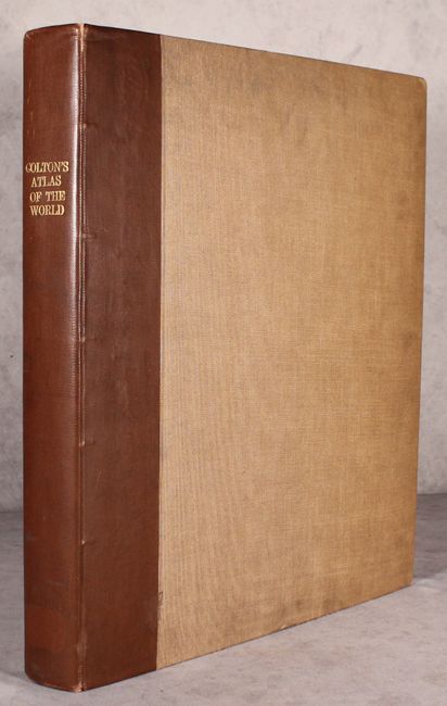
This complete folio atlas contains two volumes in one, with 105 maps/plans, each with Colton's decorative strapwork border. The atlas also includes a list of maps, text, tables, the double-page comparative chart illustrating the heights of mountains and lengths of rivers, and a frontispiece showing four women studying a large globe turned to the Eastern Hemisphere. First edition, rebound with brown cloth boards and gilt titling on spine.
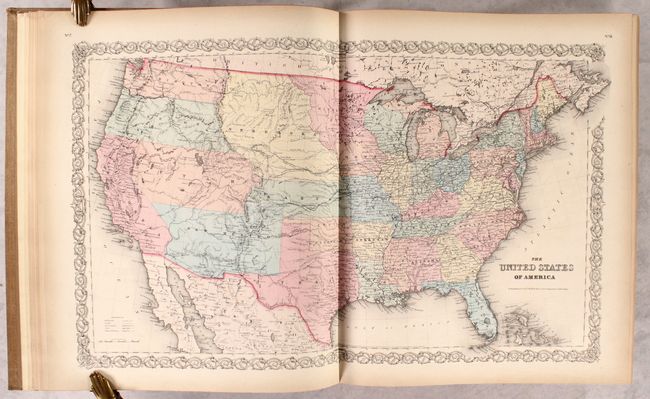
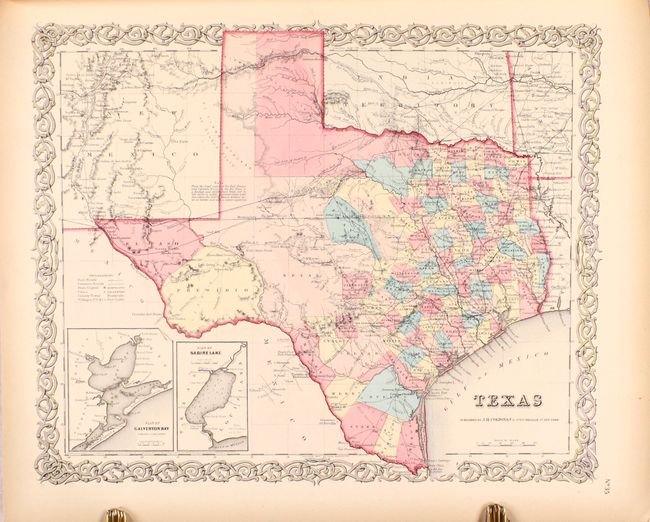
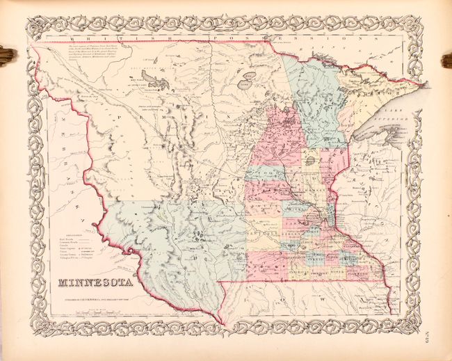
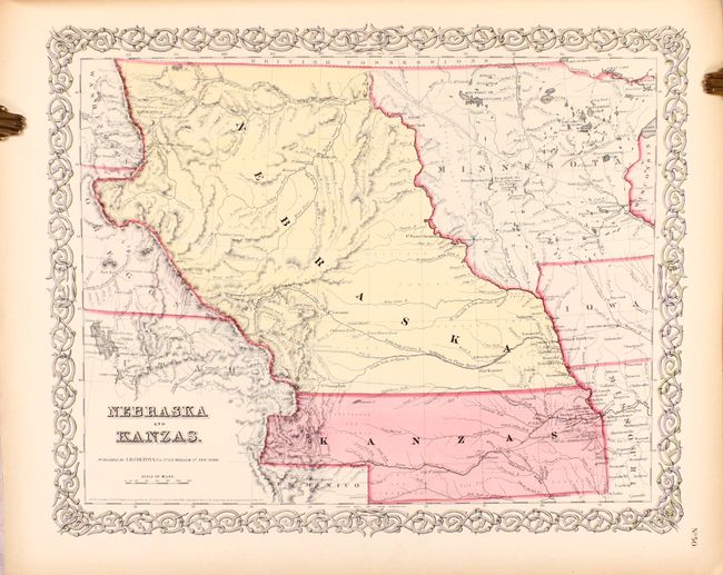
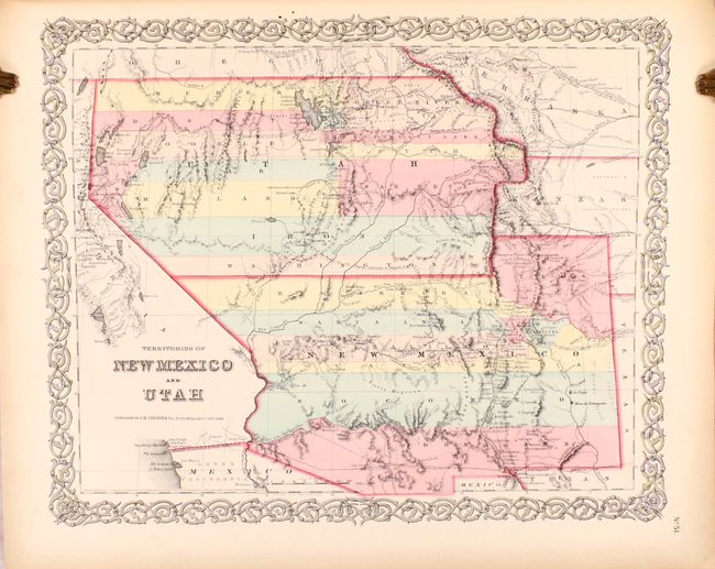
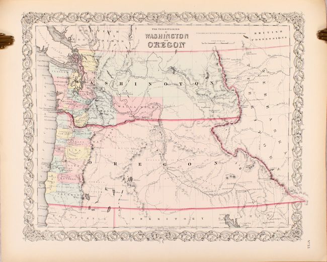
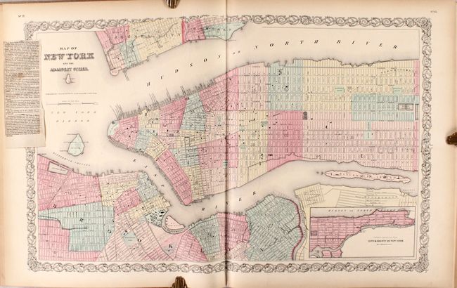
The first half of the atlas concentrates on the Western Hemisphere. There are 44 sheets relating to the United States, displaying 63 maps/plans, with numerous sought-after single-page state maps, many with city insets. There are several great early western maps including: the U.S. map featuring Kanzas; the map of Texas with early county configurations; the early map of Minnesota showing its border on the Missouri River. Also present is the most desirable Nebraska and Kanzas map that depicts Nebraska stretching from Kansas to the Canadian border and bounded on the west by Washington and Oregon at the Continental Divide and Minnesota on the east. Includes the map of the territories of New Mexico and Utah, the California map with the large inset of San Francisco, and the territories of Washington and Oregon with their eastern boundaries on the Continental Divide and county development limited to the coastal areas. City plans included are Montreal, Boston, New York (double-page), Philadelphia, Baltimore, Washington, Richmond, Norfolk/Portsmouth, Savannah/ Charleston, Louisville/New Orleans, Pittsburgh/Cincinnati, St. Louis/Chicago, Panama, Havana, Lima, Rio Janeiro, and Pernambuco.
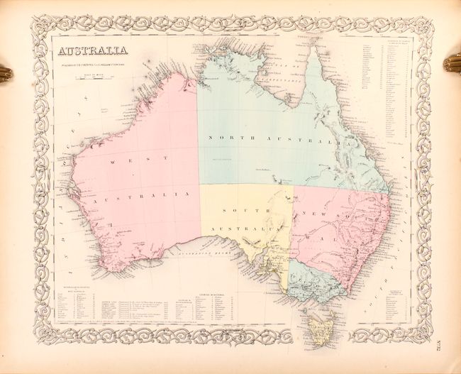
The second half of the atlas continues with 35 maps/plans of Europe, the Middle East, Africa, Asia and Oceania, including plans of London and Paris (both uncolored).
References:
Condition: A
The maps have contemporary color with minor, pleasant toning that is a bit more pronounced along the edges of the sheets, and an occasional spot of soiling. The double-page map of New York City has an article concerning the first state prison glued in the border at left. The text has mild toning, and the title page has moderate soiling and a couple of short, repaired tears. The new bindings are in very good condition (B+) with light soiling.