Subject: Colonial North America
Period: 1720 (circa)
Publication:
Color: Hand Color
Size:
15.4 x 9.4 inches
39.1 x 23.9 cm
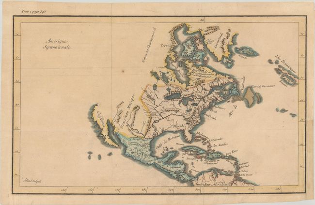
This unusual and scarce map of North America was engraved by Filloeul (Pierre?) as indicated in the lower left corner of the map. Drawn from a French perspective, it shows the English colonies confined to a narrow strip along the Atlantic Ocean with the Appalachian mountains nearly surrounding Virginia. To its west is a large Floride with the Mississippi River drawn too far to the west. Beyond the Mississippi River is Spanish-controlled New Mexico and a peninsular California. The Pacific Northwest is virtually blank. "Tome 2 page 343" is note above the top left border.
References:
Condition: B+
Issued folding with light toning and a 1" tear above the St. Lawrence River that has been closed on verso with archival materials. A binding trim at lower right has been replaced with old paper.