Catalog Archive
Auction 181, Lot 676

"A New Map of the North Part of Antient Africa Shewing the Chiefe People, Cities, Towns, Rivers, Mountains, &c. in Mauritania, Numidia, Africa Propria, Libya Propria, amd Egypt...", Wells, Edward

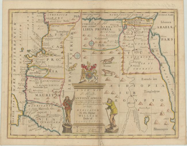
Subject: Northern Africa

Period: 1701 (circa)

Publication: A New Set of Maps...

Color: Hand Color

Size:
19.1 x 14.4 inches
48.5 x 36.6 cm
Download High Resolution Image
(or just click on image to launch the Zoom viewer)

A most unusual and interesting map with an odd orientation. The northern coastline is shown top to bottom on the left side of the map, with the coast of Egypt and two potential courses of the Nile shown on the right side with north oriented to the top. Dividing the two maps is the very large title cartouche, with two odd-looking figures, the coat of arms of the Duke of Gloucester, and lion, a cheetah and a large lizard. Engraved by R. Spofforth.

References: Shirley (BL Atlases) T.WELL-1a #38.

Condition: B

Backed in linen to repair a chip at bottom that enters the base of the title cartouche, with a small amount of image replaced in facsimile. There is light toning and soiling.

Estimate: $160 - $190

Sold for: $140

Closed on 2/10/2021

Archived