Subject: Pakistan, Afghanistan & Northern India
Period: 1640 (circa)
Publication:
Color: Hand Color
Size:
20.3 x 16.4 inches
51.6 x 41.7 cm
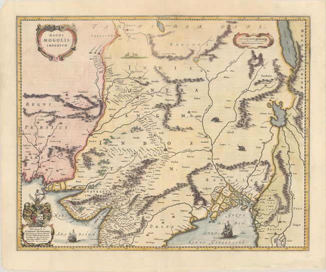
This map depicts the Empire of the Great Moghul in northern India, including the region from Iran to Burma (Myanmar). The important travel route from Kabul to Surat is the most prominent feature of the map. This was the route traveled by the embassy of the Englishman Sir Thomas Roe to the Moghul emperor Jahangir in 1615, as derived from a map published by William Baffin in London in 1618. This Dutch version of Baffin's map remained the standard Dutch view of the region throughout the seventeenth century. Finely decorated with strapwork title and scale of miles cartouches, a dedication to Johannes Huydekoper with coat of arms, sailing ships, elephants and camels. French text on verso.
References: Van der Krogt (Vol. II) #8330:2.
Condition: A
A dark impression that is a bit of weak at top center, on a bright sheet with professional repairs to several separations along the centerfold at top and to a tear that enters 1" into image at bottom.