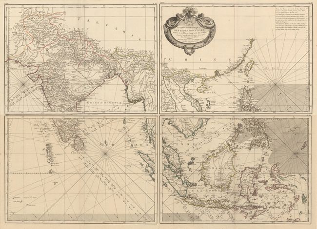
Subject: Southern & Southeast Asia
Period: 1771 (dated)
Publication: Atlas Moderne
Color: Hand Color
Size:
16.2 x 11.6 inches
41.1 x 29.5 cm
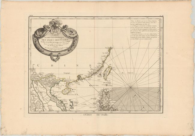
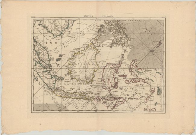
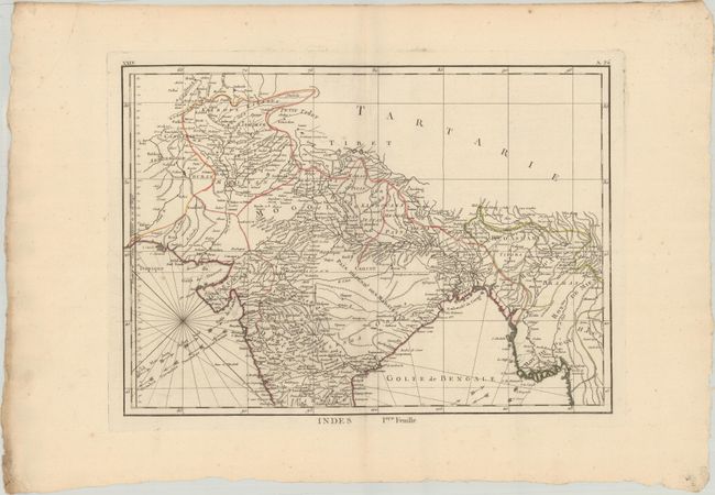
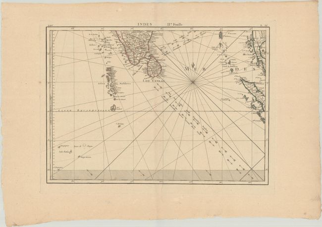
This impressive, four-sheet map extends from India to China, and as far south as New Guinea and the northern tip of Australia (here called Terre du Sud). In particular, this map shows the increase in knowledge of the East Indies, although several islands are still only partially outlined, including New Guinea, Sumba, and Sumbawa. There is excellent detail of rivers and place names, particularly along the coasts. The oceans are criss-crossed with rhumb lines and arrows denoting the trade winds. The decorative title cartouche fills the empty interior of China on the third sheet.
References:
Condition: A
Contemporary outline color on wide-margined, deckle-edged sheets with very minor soiling and a few minor spots of foxing. The first image is a composite image - the map is in 4 separate sheets.