Subject: Southern & Southeast Asia
Period: 1730 (circa)
Publication:
Color: Hand Color
Size:
22.6 x 19.1 inches
57.4 x 48.5 cm
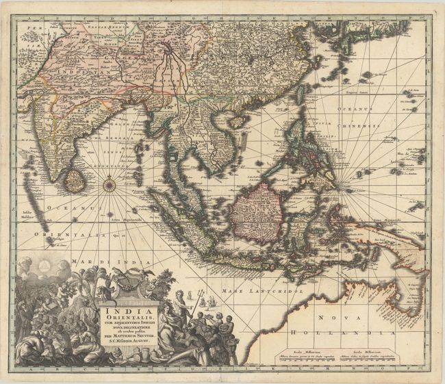
This superb map of Southern and Southeast Asia presents a detailed image of the sphere of operations and Asian trading empire of the Dutch East India Company. The map extends from India to the Philippines and the Ladrone Islands, and from southern Japan to the recent Dutch discoveries in Northern Australia. There is a partial outline of Papua New Guinea, which is shown connected to Nova Hollandia within the border of the map. There is considerable cartographic data in the East Indies, although the islands are still taking shape. The mythical Chiamay Lacus is still shown in western China with fiver rivers flowing south. The fabulous title cartouche is surrounded by various people and animals of the region and a bounty of trade goods.
References:
Condition: B+
A dark impression on a sturdy sheet with some tiny mildew spots and a couple of tiny edge tears.