Catalog Archive
Auction 181, Lot 630

"IIe. Feuille Particuliere de la Tartarie Chinoise Contenant les Environs de Nimgouta, qui est Proprement l'Ancien Pays des Mantcheoux, et l'Extremite la Plus Septentrionale de la Coree", Anville, Jean Baptiste Bourguignon d'

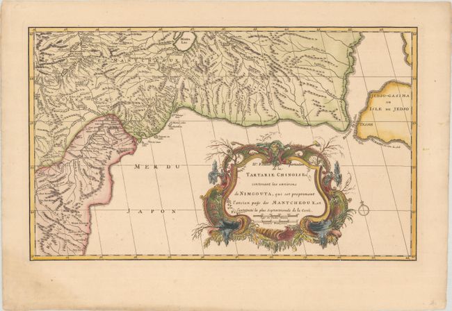
Subject: China, Korea & Russia

Period: 1737 (published)

Publication: Nouvel Atlas de la Chine, de la Tartarie Chinoise, et du Thibet

Color: Hand Color

Size:
18.6 x 11.3 inches
47.2 x 28.7 cm
Download High Resolution Image
(or just click on image to launch the Zoom viewer)

This map of the Chinese Tartary shows the region around Ning'an (Nimgouta), which is at top left, northern Korea, and part of Russia near Lake Khanka. D'Anville assembled maps of China compiled from an extensive Jesuit survey carried out in 1708-16 for the Emperor Kang-Shi, which were published in Jean Baptiste du Halde's Description Geographique Historique... de l'Empire de la Chine et de la Tartarie Chinoise in 1735. It remained the principal cartographical authority on China during the rest of the 18th century. The missionaries used local sources and personal observation to prepare these incredibly detailed maps. The maps were then re-engraved by D'Anville for a Dutch market two years later and published in an atlas volume, Nouvel Atlas de la Chine, de la Tartarie Chinoise, et du Thibet.

References: Shirley (BL Atlases) T.HALD-3a #20.

Condition: A

A sharp impression with a small hole along the neatline at bottom right and light soiling along the edges of the sheet.

Estimate: $140 - $170

Sold for: $100

Closed on 2/10/2021

Archived