Subject: Northern China & Russia
Period: 1737 (published)
Publication: Nouvel Atlas de la Chine, de la Tartarie Chinoise, et du Thibet
Color: Hand Color
Size:
18.7 x 11.3 inches
47.5 x 28.7 cm
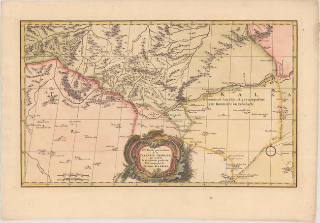
This map centers on the Amur River, the boundary between China and Russia, with the Ergun River illustrated in the bottom left corner. The region represents the lands occupied by the Kalka Tartars. D'Anville assembled maps of China compiled from an extensive Jesuit survey carried out in 1708-16 for the Emperor Kang-Shi, which were published in Jean Baptiste du Halde's Description Geographique Historique... de l'Empire de la Chine et de la Tartarie Chinoise in 1735. It remained the principal cartographical authority on China during the rest of the 18th century. The missionaries used local sources and personal observation to prepare these incredibly detailed maps. The maps were then re-engraved by D'Anville for a Dutch market two years later and published in an atlas volume, Nouvel Atlas de la Chine, de la Tartarie Chinoise, et du Thibet.
References: Shirley (BL Atlases) T.HALD-3a #25.
Condition: A
A sharp impression with light soiling along the edges of the sheet.