Subject: Western Hemisphere - America
Period: 1716 (published)
Publication:
Color: Hand Color
Size:
22.6 x 19.3 inches
57.4 x 49 cm
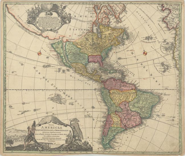
This lovely early edition of Homann's map of the Americas shows California as an island on the second Sanson model. The Fretum Anian forms an entrance to a potential Northwest Passage between California and the mythical Terra Esonis Incognita, which forms a nearly continuous land bridge from North America to Asia. The Mississippi River and Great Lakes show the results of the early French Jesuit explorations. A large lake in the Southeastern United States is a remnant of Le Moyne's mythical cartography of the previous century. In South America, the Capitanias of Brazil are delineated and the Amazon and other interior features are beginning to take realistic form. The map is embellished with two fine cartouches, each with scenes of natives, Jesuits, and European merchants.
References: McLaughlin #175; Tooley (Amer) p. 129 #79; Portinaro & Knirsch #109.
Condition: B+
A nice impression with full contemporary color on watermarked paper. There is light soiling, a printer's crease extending through the title cartouche, and a short centerfold separation at bottom. The map has been trimmed to the neatline at top and bottom center by the bookbinder.