Catalog Archive
Auction 181, Lot 609

"Carte de la Mer Caspiene Distinguee Suivant les Differentes Representations des Geographes tant Anciens que Modernes Jointes a Celle de sa Majeste Czariene", Liebaux, Jean Baptiste

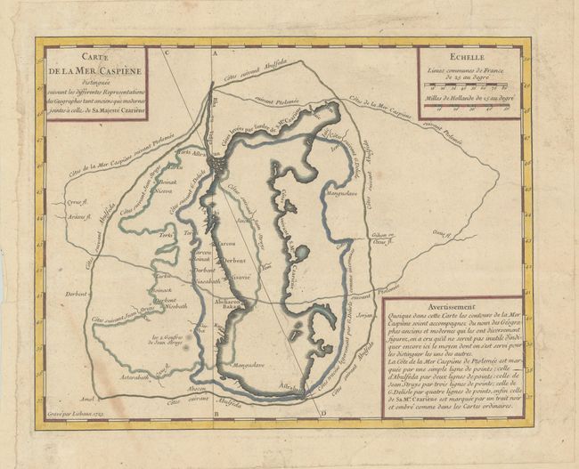
Subject: Caspian Sea

Period: 1723 (dated)

Publication:

Color: Hand Color

Size:
11.8 x 9.3 inches
30 x 23.6 cm
Download High Resolution Image
(or just click on image to launch the Zoom viewer)

This interesting engraving shows how the depiction of the Caspian Sea on maps changed over time. The most recent shape of the Caspian Sea is shown at center, as drawn by geographer Carl van Verden on behalf of his Majesty the Czar. Various dotted lines show the proposed shapes from various geographers, including those by Ptolemy, Arab Prince Abulfeda, Jean Struys, and Delisle. A very uncommon map.

References:

Condition: B+

The original sheet has been trimmed and pasted onto a new sheet of paper (with a bunch of grapes watermark) for inclusion in a composite atlas. There is some soiling in the image at bottom left.

Estimate: $200 - $230

Sold for: $100

Closed on 2/10/2021

Archived