Subject: Persia - Iran
Period: 1764-70 (circa)
Publication:
Color: Black & White
A. La Perse, by Jacques Nicolas Bellin, from Le Petit Atlas Maritime, circa 1764 (13.9 x 9.4"). This handsome map of the region roughly centers on Sirjan ou Kerman. There are plenty of place names, although a note to the right of the title cartouche states that villages and less significant places have been omitted to avoid confusion. A decorative title cartouche with a distance scale appears in the bottom left corner. Condition: On watermarked paper with faint offsetting and marginal toning. (A)
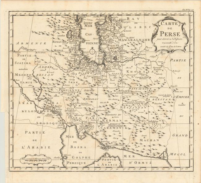
B. Carte de Perse pour Servir a l'Histoire Universelle, d'une Societe de Gens de Lettres, by Anton Francois Prevost, circa 1770 (14.5 x 12.6"). This attractive French map covers the Persian Empire. It shows the regional divisions and is filled with place names and explanatory notations. Condition: A sharp impression issued folding with light scattered foxing. There is a binding trim in the left margin with an associated tear that just passes the border and has been repaired on verso with archival materials. (B+)
References:
Condition:
See description above.