Subject: Holy Land
Period: 1677 (circa)
Publication: Naukeurige Beschrijving van Gantsch Syria en Palestyn…
Color: Black & White
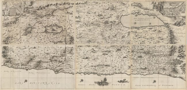
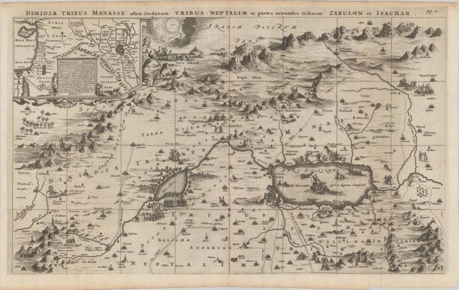
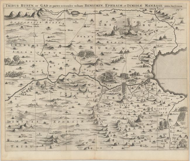
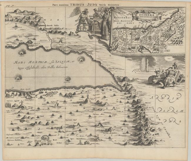
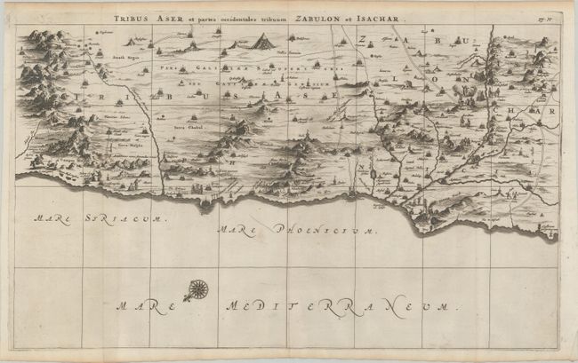
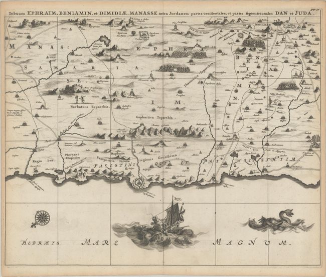
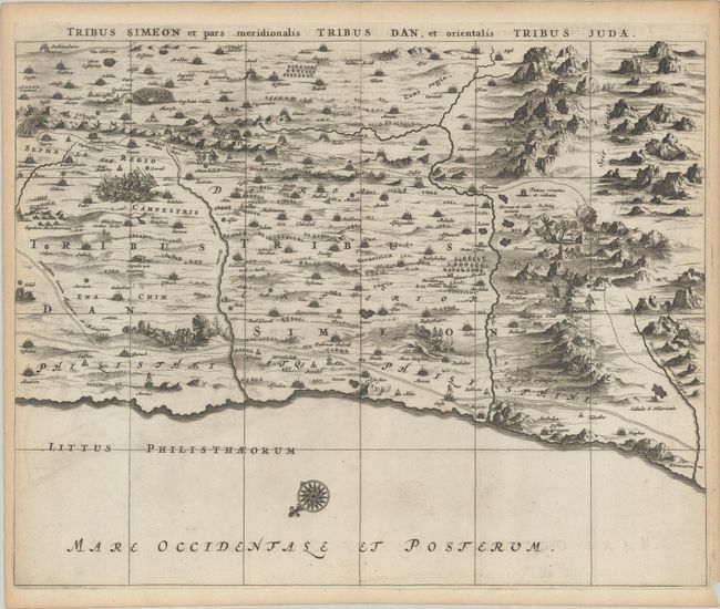
This superb, large wall map on six joined sheets is based on Adrichom's Situs Terrae Promissionis. Oriented to the east, the map shows the region divided into the twelve tribes on both sides of the Jordan River, the shoreline running from Sidon to Alexandria. The Cison Torrens (Kishon River) is shown as connecting the Sea of Galilee with the Mediterranean Sea, and there are many nonexistent rivers, e.g., a river connecting Jerusalem with the Dead Sea. In the Dead Sea, four burning cities are shown: Sodoma, Gomorra, Seboim, and Adama. On the Tribuum Ephraim sheet, a vignette at bottom shows Jonah being tossed to the whale. The dramatic map is beautifully engraved to show topographical features, major roads, towns and villages and richly embellished with dozens of biblical illustrations. Inset maps in the top corners depict Abraham's journey and the wandering of the Israelites through the desert; both are surrounded by beautifully engraved biblical vignettes. If joined, the map would measure approximately 47.5 x 22.5".
A. Dimida Tribus Manasse Ultra Jordanem Tribus Neptalim et Partes Orientales Tribuum Zabulon et Isachar, (18.8 x 11.1").
B. Tribus Ruben, et Gad et Partes Orientales Tribuum Beniamin, Ephraim, et Dimidiae Manasse Intra Jordanem, (14.3 x 11.1").
C. Pars Maxima Tribus Iuda Versa Orientem, (14.2 x 11.1").
D. Tribus Aser et Partes Occidentales Tribuum Zabulon et Isachar, (18.9 x 11.3").
E. Tribuum Ephraim, Beniamin, et Dimidiae. Manasse Intra Jordanem Partes Occidentales, et Partes Septentrionales Dan et Juda, (14.3 x 11.3").
F. Tribus Simeon et Pars Meridionalis Tribus Dan, et Orientalis Tribus Juda, (14.3 x 11.3").
References: Laor #233-238.
Condition: A
Dark impressions on watermarked sheets with a bit of faint offsetting and minor toning confined to the margins. The first image is a composite image - the map is in six separate sheets.