Subject: Middle East
Period: 1731-60 (circa)
Publication:
Color: Black & White
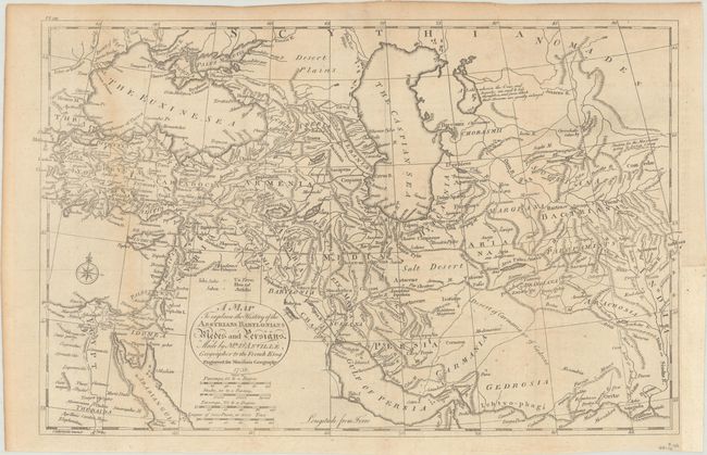
A. A Map to Explain the History of the Assyrians Babylonians Medes and Persians, by John Payne, from A New and Complete System of Universal Geography..., dated 1739 (15.9 x 10.1"). This detailed map covers from the Black Sea, Turkey, Cyprus, the Holy Land, and Egypt east to the Indus River. The map names ancient historical regions, locates numerous towns and cities, and features nice topographical detail. Published by R. Morison and Son. Engraved by Rymer. Reference: McCorkle (18th-C. Geography Books) #328 Vol. II-11. Condition: Issued folding on watermarked paper with minor toning along the edges and the fold at left and faint offsetting. There is a binding trim in the right margin that has been replaced with old paper and an associated tear that has been archivally repaired on verso. (B+)
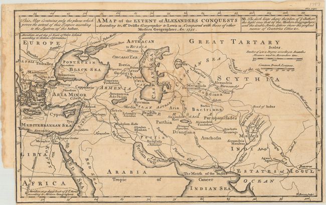
B. A Map of the Extent of Alexanders Conquests According to Mr. Delisle Geographer to Lewis 14. Compared with Those of Other Modern Geographers, by Emanuel Bowen, dated 1731 (13.4 x 8.4"). Emanuel Bowen engraved this interesting map comparing the empire of Alexander the Great according to Guillaume Delisle and "other Modern Geographers." According to the key, the dark lines indicate Delisle's scientific approach to cartography, while the lighter lines show the work of other geographers. Condition: A dark impression issued folding with offsetting, toning, a couple small spots, and a binding trim and short associated tear at bottom left. (B)
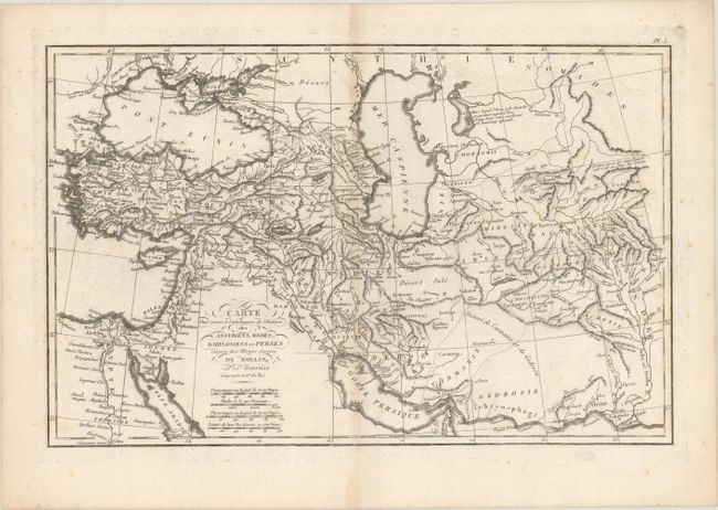
C. Carte pour Servir a l'Intelligence de l'Histoire des Assyriens, Medes, Babyloniens et Perses Comprise dans l'Histoire Ancienne de Rollin, by Jean Baptiste Bourguignon d'Anville, from Histoire Ancienne..., circa 1760 (16.4 x 10.5"). This handsome map focuses on the Middle East and Caucasus. It first appeared in volume 1 of Charles Rollin's multi-volume Histoire Ancienne in 1740, with many subsequent editions appearing in both French and English into the 19th century. Place names reflect the nomenclature of classical antiquity. The map features fine topographical detail. Reference: cf. Shirley (BL Atlases) G.ROLL-1a #5. Condition: There is light toning along the centerfold, some minor scattered foxing, and faint offsetting. (B+)
References:
Condition:
See description above.