Catalog Archive
Auction 181, Lot 579

"[Lot of 2] Kaarte van het Aardsche Paradys, Volgens het Ontwerp van den Schryver...", Starckman, P.

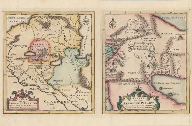
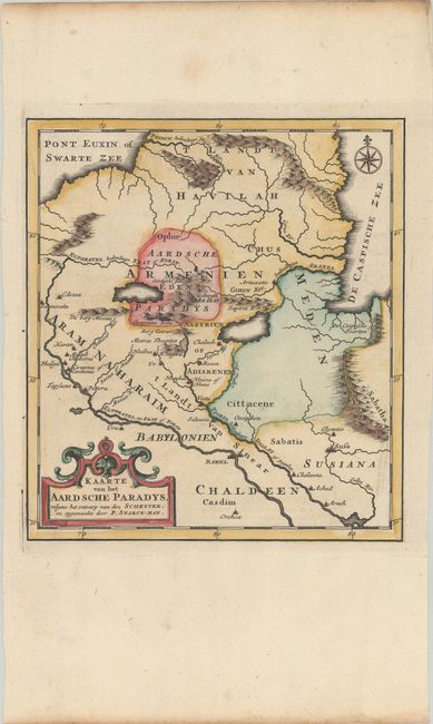
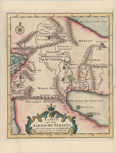
Subject: Middle East

Period: 1725 (circa)

Publication: Het Algemeen Groot Historisch, Oordeelkundig, Chronologisch, Geografisch ... van den Gantschen H. Bybel

Color: Hand Color

Size:
8.2 x 9.2 inches
20.8 x 23.4 cm
Download High Resolution Image
(or just click on image to launch the Zoom viewer)

Two different possible locations for the Garden of Eden are shown on this pair of maps. One locates the Garden north of Babylon in the Armenian region in the vicinity of Mount Ararat and the headwaters of the Euphrates River. The other map shows the more traditional theory, with Paradise located south of Babylon on the Euphrates River. The second sheet includes the imprint of the engraver, Jacob Keyser. Published in a Dutch edition of Calmet's dictionary of the Holy Bible.

References:

Condition: A

Crisp impressions on bright sheets with the watermarks of "Beavuais" on one sheet and a coat of arms on the other. The second sheet has an extraneous crease at left and a narrow right margin. The first image is a composite image - the maps are on two separate sheets.

Estimate: $220 - $250

Sold for: $160

Closed on 2/10/2021

Archived