Subject: Eastern Mediterranean & Middle East
Period: 1598 (published)
Publication: Theatrum Orbis Terrarum
Color: Hand Color
Size:
19.3 x 14.6 inches
49 x 37.1 cm
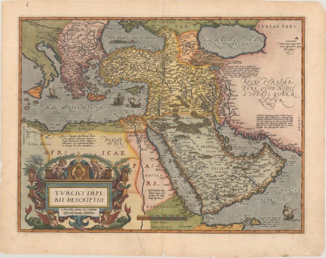
This is Ortelius' second map of the Turkish Empire, based on Ortelius' own map of Asia, which was derived from the work of Italian mapmaker Giacomo Gastaldi of 1561. It features the Arabian Peninsula prominently and illustrates the coastlines fairly well but most of the interior information is completely hypothetical with many place names taken from antiquity and legend. The Red Sea (Mare de Mecca) is shown relatively accurately whereas the Persian Gulf (Mare Elcatif) is misshapen due to the exaggerated Arabian shoreline. The map is richly embellished with sailing ships, a sea monster in the Black Sea, and a superb, strapwork title cartouche topped by cherubs and supported by a pair of female, winged sea monsters. French text on verso.
References: Ankary #15; Tibbetts #42; Van den Broecke #169.
Condition: B+
A crisp impression with a tiny abrasion in the border at top, a professionally repaired tear that enters 2" into the image at bottom, and a few tiny chips and tears along the edges of the sheet.