Subject: Mediterranean
Period: 1817 (dated)
Publication: New General Atlas
Color: Hand Color
Size:
23.4 x 19.1 inches
59.4 x 48.5 cm
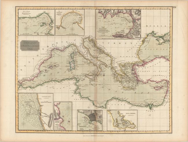
Very handsome chart of the Mediterranean Sea from the Strait of Gibraltar to the coasts of Egypt, Turkey and Palestine. The chart extends north to include the Black Sea, and shows islands with numerous place names along the coasts. Includes seven inset charts with bird's-eye plans, soundings, and sea battle plans: Bay & Roads of Marseilles; The Harbour of Genoa; Plan of the Rock & Bay of Gibraltar Shewing the Position of the Combined Fleet and Attack of the Battering Ships in 1782; Leghorn Road; Sketch of the Watering Place of Algeziras; Attack on Algiers by the Fleet under the Command of Admiral Lord Exmouth. Aug. 22, 1816; and Gulf of Smyrna.
References:
Condition: B+
A nice impression with contemporary color on a sheet watermarked "1815." There is light offsetting with toning along the centerfold and sheet edges.