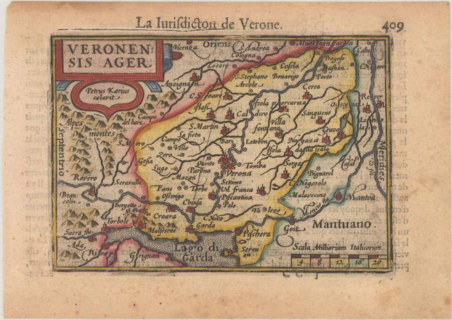
Subject: Northern Italy
Period: 1600 (published)
Publication: Thresor de Chartes
Color: Hand Color
Size:
4.9 x 3.4 inches
12.4 x 8.6 cm
This handsome miniature map is centered on Verona, with north oriented to the left. The map extends west to Lake Garda and east to Vicenza, and depicts numerous small towns, rivers and mountains. French text on verso.
The map was first published by Cornelius Claesz and printed by Barent Langenes in the 1598 edition of the popular Map-treasury. For the 1599 edition, graduation lines and latitude numerals were added to one side of the border on most of the maps, which were again used for multiple editions through 1650. This is the second state with the added graduation lines from a French edition, printed by Albert Hendricks.
References: King (2nd ed.) pp. 80-82; Van der Krogt (Vol. III) #7111:341.
Condition: B+
A nice impression with light toning and marginal soiling.