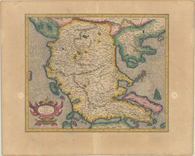
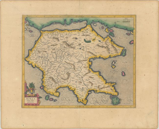
Subject: Greece
Period: 1609 (published)
Publication: Gerardi Mercatoris - Atlas sive Cosmographicae
Color: Hand Color
Size:
16.9 x 13.9 inches
42.9 x 35.3 cm
This matching pair of finely engraved maps set the standard for maps of the region for most of the 17th century. The cartography is based largely on the work of Jacopo Gastaldi. The narrow isthmus that separates the mainland from the Peloponnesos peninsula is now bisected by the Corinth Canal, built in 1893, effectively turning the peninsula into an island. The strapwork title cartouche on the northern sheet is topped by a skull, and on the southern sheet with a floral arrangement. French text on verso.
References: Van der Krogt (Vol. I) #7820:1A.1 & #7830:1.1; Zacharakis #1448 & #1449.
Condition: B+
Full contemporary color on lightly toned sheets with small coat of arms watermarks and scattered foxing. The northern sheet has several dampstains confined to the blank margins.