Subject: Southeastern Europe
Period: 1820 (circa)
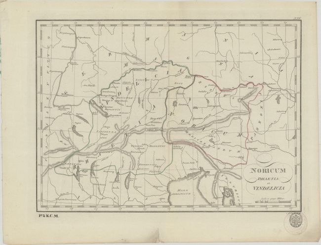
Publication: Tabulae Geographicae Orbis Veteribus Noti
Color: Hand Color
Size:
15.5 x 11.3 inches
39.4 x 28.7 cm
This simple yet elegantly engraved map centers on the ancient regions of Raetia, Vindelicia, and Noricum. It was published in Franz Reisser's rare atlas Tabulae Geographicae Orbis Veteribus Noti. The map spans from the Rhine east into the province of Pannonia. It names numerous ancient towns and cities. There is nice topographical detail of the Alps and the region's lakes and rivers. The Upper Germanic-Rhaetian Limes are noted stretching from the Neckar to the Danube. A K.K. Schulbucher-Verschleiss-Administration stamp appears at bottom right below the map.
References:
Condition: A
On paper with "J.R." and "W 59" watermarks. There are some faint spots and an edge tear in the bottom blank margin.