Subject: Cartographic Miscellany, Fictional Map
Period: 1920 (circa)
Publication:
Color: Printed Color
Size:
12.9 x 8.7 inches
32.8 x 22.1 cm
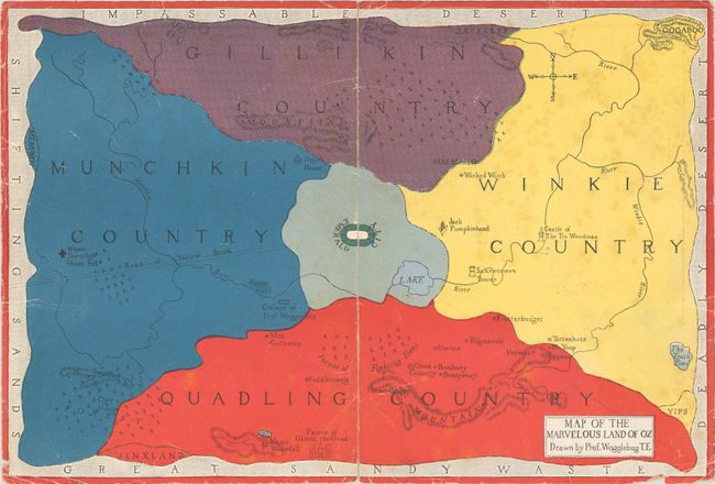
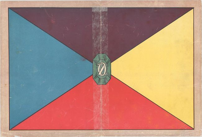
This pictorial map provides the setting for L. Frank Baum's wonderful series of children's books beginning in 1900 with The Wonderful Wizard of Oz. The map is divided into four countries including Munchkin, Gillikin, Winkie, and Quadling with Emerald City at center. It includes several places recognizable from the acclaimed 1939 movie (if you haven't read the series) including the Road of Yellow Brick, Where Dorothy's House Fell, Scarecrow's Tower, Castle of the Tin Woodman, and the Wicked Witch. The map was "drawn" by Professor Wogglebug, whose college is located close to Emerald City. The verso contains the flag of Oz with an emerald at center. While there is no attribution on this map, it was laid into early volumes of Oz books by the publisher, Reilly & Lee.
References:
Condition: B
The map has fully separated along the centerfold and has been rejoined with tissue on verso. There is some scattered foxing, light wear, and a couple of tiny edge chips and tears.