Catalog Archive
Auction 181, Lot 500

"Etats de Boheme, Divises en Toutes Leurs Provinces, tant Civiles qu' Ecclesiastiques", Brion de la Tour/Desnos

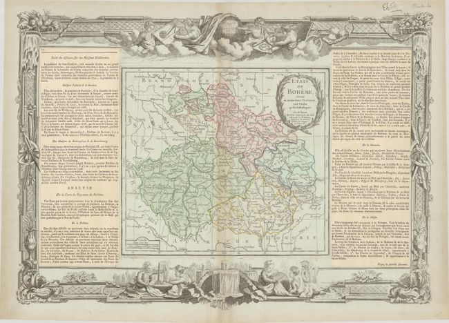
Subject: Czech Republic

Period: 1766 (dated)

Publication: Atlas General Methodique et Elementaire

Color: Hand Color

Size:
20.4 x 14.4 inches
51.8 x 36.6 cm
Download High Resolution Image
(or just click on image to launch the Zoom viewer)

This copper engraved map centers on modern-day Czech Republic. It also extends to include portions of Germany, Poland, Slovakia, Hungary, and Austria. There is good detail throughout the region and several cities are identified including Prague, Pilsen, Lubben, Lignitz (Legnica), Breslau (Wroclaw), Olmutz (Olomouc), Teschen, Berlin, Leipzig, Dresden, etc. It includes a rococo-style title cartouche. The map (10.1 x 9.2") is surrounded by an elaborate border incorporating scenes of putti, globes, instruments, etc. and flanked by columns of French text pasted on the sheet, as was common practice at the time.

References:

Condition: B+

On a bluish watermarked sheet with light toning along the centerfold and a few minor spots.

Estimate: $180 - $220

Sold for: $130

Closed on 2/10/2021

Archived