Subject: Eastern Germany & Western Poland
Period: 1730 (circa)
Publication:
Color: Hand Color
Size:
22.4 x 19.3 inches
56.9 x 49 cm
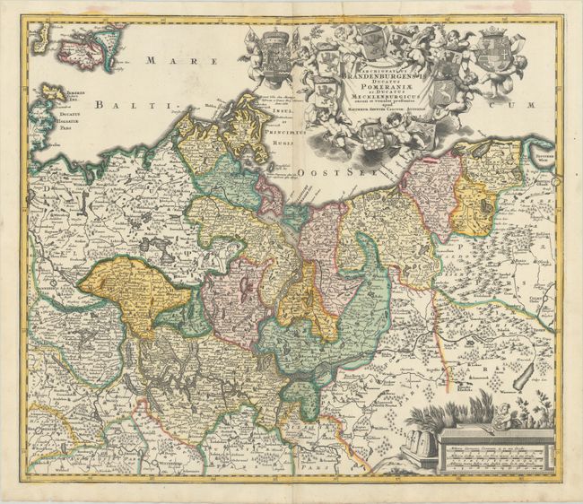
This handsome German map centers on the Szczecin Lagoon and covers the area surrounding the modern-day border between Germany and Poland. The map spans from Halberstadt east to Gdansk and extends to show some of Danish islands, most notably Lolland and Falster. It is rich with detail, showing political boundaries, towns, cities, rivers, and forests. An elaborate title cartouche featuring putti and numerous coats-of-arms dominates the upper right corner of the map image. At bottom right, there is a distance scale cartouche featuring beehives, a field of wheat, and a putto with navigational instruments.
References:
Condition: B+
A nice impression on a sheet with an elephant watermark. There is a 2" centerfold separation at bottom that has been closed with archival materials on verso, very light toning along the centerfold, and a couple printer's creases and extraneous crease at top.