Subject: Northern Germany
Period: 1649 (dated)
Publication: Nuevo Atlas
Color: Hand Color
Size:
23.6 x 15.8 inches
59.9 x 40.1 cm
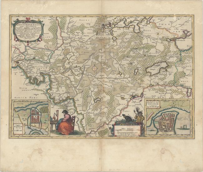
This decorative map details the region in Schleswig-Holstein bounded by Friedrichstadt in the west, Schleswig in the north, Eckernforde in the east, and Rendsburg in the south. Forests, rivers, roads, and cities are depicted throughout the map. In the bottom corners are bird's-eye plans of Friedrichstadt and Eckernforde. The map is adorned with a strapwork title cartouche, a distance scale featuring a hunter and his dog, and what appears to be a merchant using a scale. The cartography is credited to Johannes Mejer and the map is dedicated to Johannes Hekelauer. Spanish text on verso, published between 1659-72.
References: Van der Krogt (Vol. II) #1637:2.2.
Condition: B
Full contemporary color on paper with the watermark of Atlas. There are scattered dampstains, some abrasions in the top corners of the image as well as in the distance scale, and several worm tracks in the bottom blank margin.