Subject: Central Europe, Germany
Period: 1626 (dated)
Publication: A Prospect of the Most Famous Parts of the World...
Color: Hand Color
Size:
20.6 x 15.9 inches
52.3 x 40.4 cm
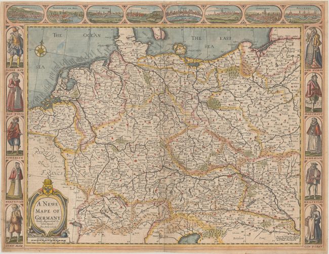
This decorative map displays the German Empire, covering the area from Belgium and the Netherlands east to Poland and Hungary. The map is filled with place names and pictorial representations of topography. Along the top of the map are birds-eye views of Heidelberg, Frankfurt, Vienna, Prague, Cologne, Nuremberg, Strasbourg, and Augsburg. Along the left and right are various costumed figures including a nobleman, merchant, Bohemian, and Helvetian, to name a few. The imprint of Basset and Chiswell appears at bottom right. English text on verso, published in 1676.
References: Shirley (BL Atlases) T.SPE-2f.
Condition: B
There is an archivally repaired edge tear that extends 7" into the image at top along with some light dampstaining in the bottom corners. A 1" chip near the centerfold at bottom has been replaced with part of the image drawn in facsimile.