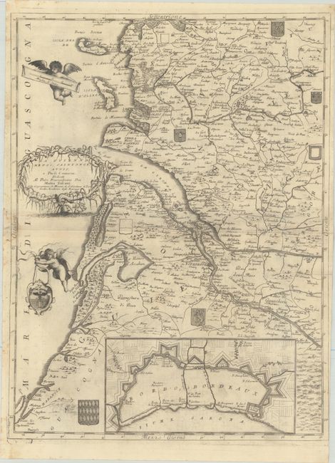
Subject: Bordeaux, France
Period: 1696 (circa)
Publication: Isolario Descrittione Geografico-Historica...
Color: Black & White
Size:
17.8 x 23.8 inches
45.2 x 60.5 cm
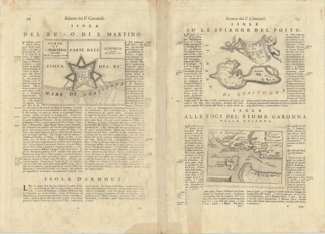
This elegantly detailed map covers Guyenne and the Bordeaux wine region of France. It centers roughly on the Gironde estuary and extends to show the Ile de Re and Ile d'Oleron. Numerous towns and cities are identified, including Bordeaux, Cognac, Rochefort, and Marmande. An inset at bottom details the fortifications of Bordeaux. The map is further decorated by several coats of arms scattered across the landscape, putti, and an elaborate title cartouche. On verso, three additional maps are embedded into the Italian text: Forte di S. Martino (6.6 x 5.1"); Isola di Narmoustier (6.4 x 5.1"); and Bocca del Fiume Garonna (5.9 x 4.1").
References: Shirley (BL Atlases) T.CORO-13a #167-170.
Condition: B+
A nice impression on watermarked paper with a light dampstain that enters map image along the centerfold at left, minor offsetting, and printer's ink residue. There are a few tears that have been closed on verso with archival materials, including a 4" tear at right.