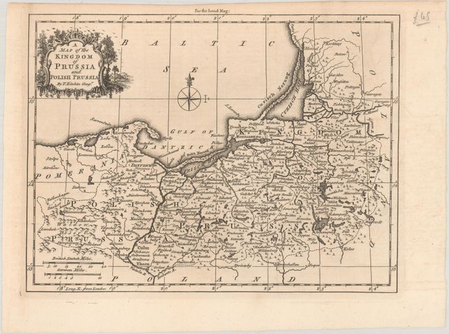
Subject: Baltic
Period: 1757 (circa)
Publication: London Magazine
Color: Black & White
Size:
9.2 x 6.9 inches
23.4 x 17.5 cm
This handsome map centers on the Gulf of Gdansk and extends to include part of present-day Kaliningrad and Lithuania. It includes a decorative title cartouche at top left, a compass rose capped by a fleur-de-lis, and two distance scales. The map was published by London Magazine as part of a series of maps covering much of Central Europe, with an emphasis on the German Empire. These maps were published from 1756 to 1758 and illustrated the beginning of the Seven Years War. London Magazine was one of the major British periodicals of the 18th century and contained a great many finely engraved maps illustrating the important events of the period.
References: Jolly #LOND-128.
Condition: A
A nice impression issued folding with a hint of offsetting.