Catalog Archive
Auction 181, Lot 425

NO RESERVE

"Carte du Royaume d'Angleterre Projettee et Assujettie aux Observations Astrononomiques", Bonne/Lattre

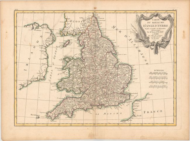
Subject: England & Wales

Period: 1771 (dated)

Publication: Atlas Moderne

Color: Hand Color

Size:
16.4 x 11.8 inches
41.7 x 30 cm
Download High Resolution Image
(or just click on image to launch the Zoom viewer)

An attractive map of England and Wales, extending to show partial coastlines of Scotland, Ireland, and France. The map divided into counties with detail of cities and towns, rivers, and topography filling the interior. Adorned by a decorative title cartouche engraved by Arrivet and four distance scales.

References:

Condition: B+

A nice impression with contemporary color, light soiling, and some dampstains and toning along the edges of the sheet.

Estimate: $60 - $80

Sold for: $21

Closed on 2/10/2021

Archived