Catalog Archive
Auction 181, Lot 422

"Anglia", Mercator/Hondius

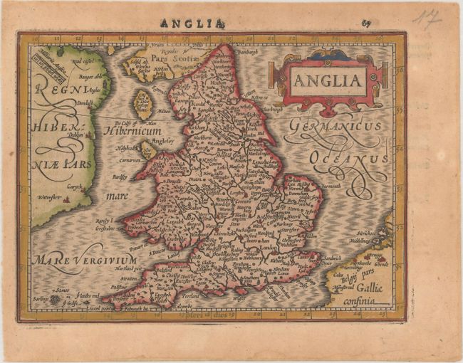
Subject: England & Wales

Period: 1621 (published)

Publication: Atlas Minor

Color: Hand Color

Size:
7.3 x 5.4 inches
18.5 x 13.7 cm
Download High Resolution Image
(or just click on image to launch the Zoom viewer)

Nicely engraved small map of England and Wales derived from Mercator's map of 1595. Part of Ireland is shown across the Irish Sea, and the coast of Belgium is shown as well. The map is adorned with a strapwork title cartouche and a scale of miles drawn diagonally across northern Ireland. Latin text on verso.

References: Shirley (BI to 1650) #312; Van der Krogt (Vol. III) #5100:351.

Condition: B+

A nice impression on a lightly toned sheet.

Estimate: $140 - $170

Sold for: $100

Closed on 2/10/2021

Archived