Subject: Western England
Period: 1675 (circa)
Publication: Britannia
Color: Hand Color
Size:
17.5 x 12.3 inches
44.5 x 31.2 cm
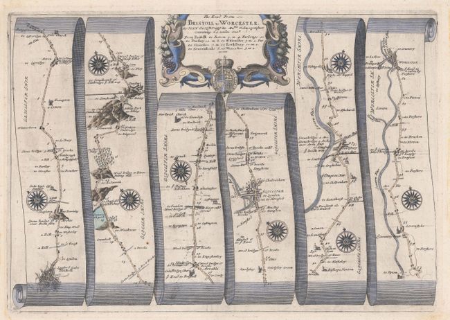
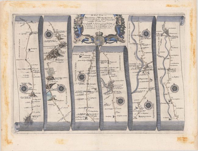
John Ogilby's 'Britannia' was published between 1675 and 1698. It is a landmark in the mapping of England and Wales. Its unique format constituted the first national road-atlas of any country in Western Europe. It was composed of maps of seventy-three major roads and cross-roads, presented in a continuous strip-form, on a uniform scale of one inch to a mile. Each beautiful map includes wonderful detail of the countryside with each strip containing a large compass rose to indicate changes in direction.
Attractive strip-style map covering the road from Bristol to Worchester in six strips totaling 62 miles. Each of the six panels has at least one decorative compass rose to orient the traveler. The title cartouche is surrounded by fruit and vegetation, representing this rich agricultural region, and the royal coat of arms.
References: Shirley (BL Atlases) T.OGIL-4a #59.
Condition: A
A crisp impression on a bright sheet with a printer's crease adjacent to the centerfold at top and remnants of hinge tape on verso. There are significant stains confined to the blank margins that would be completely obscured if framed and do not impact the quality of the paper.