Subject: Southern England
Period: 1675 (circa)
Publication: Britannia
Color: Hand Color
Size:
17.4 x 13.3 inches
44.2 x 33.8 cm
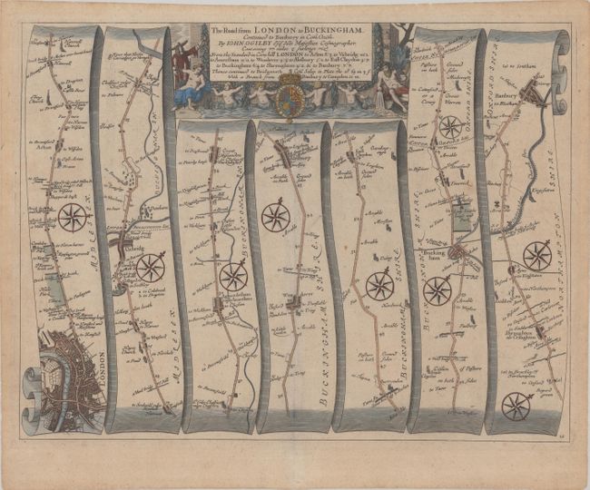
John Ogilby's 'Britannia' was published between 1675 and 1698. It is a landmark in the mapping of England and Wales. Its unique format constituted the first national road-atlas of any country in Western Europe. It was composed of maps of seventy-three major roads and cross-roads, presented in a continuous strip-form, on a uniform scale of one inch to a mile. Each beautiful map includes wonderful detail of the countryside with each strip containing a large compass rose to indicate changes in direction.
Attractive strip-style map covering the road from London to Banbury in seven strips totaling 77 miles. The map begins with a fine plan of London and proceeds to the west and northwest as it passes through Uxbridge, Aylesbury, Buckingham, and on to Banbury. Each of the seven panels has at least one decorative compass rose to orient the traveler. The title cartouche features a River God pouring an urn of water, several mer-children, and the royal coat of arms.
References: Shirley (BL Atlases) T.OGIL-4a #12.
Condition: B+
A crisp impression with very light toning and remnants of hinge tape on verso.