Subject: Eastern England
Period: 1575 (dated)
Publication: [An Atlas of England and Wales]
Color: Hand Color
Size:
18.9 x 13.1 inches
48 x 33.3 cm
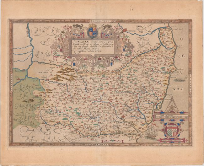
This beautifully engraved map of Suffolk was issued in Christopher Saxton's county atlas of England and Wales. It is widely considered to be the first national atlas in the world, and contains a total of 35 county maps. This example comes from the first edition published in 1579, with subsequent editions occurring up to 1772. Saxton's maps were countlessly copied over the next 200 years, and it wasn't until the Principal Triangulation of Great Britain beginning in 1784 did his maps become obsolete. Cartographically, the map extends west to Ely, north to Norwich, and is filled with tiny towns, rivers, mountains, and forests. The map is further embellished with two strapwork cartouches; the title cartouche surmounted by the coat of arms of Elizabeth I; and the distance scale includes the coat of arms to Thomas Seckford (Saxton's patron) and measuring dividers. Saxton's imprint appears at bottom center. Blank verso. An important map for any British collection.
References: Shirley (BL Atlases) T.SAX-1b.
Condition: B+
Full contemporary color on paper with a crossed arrows watermark, with light toning, soiling, and foxing. There is an old manuscript page number in the top margin.