Subject: Guyana, Suriname, French Guiana
Period: 1683 (circa)
Publication: Geographise en Historise Werelt Beschryving
Color: Hand Color
Size:
10.9 x 7.9 inches
27.7 x 20.1 cm
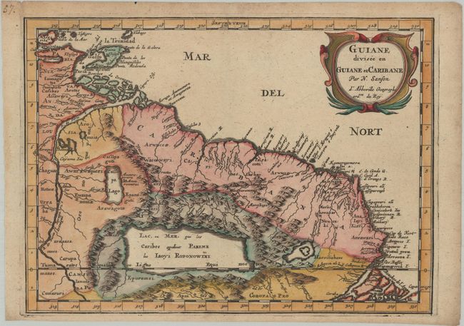
This small map covers the coastline from Trinidad to the mouth of the Amazon River. The interior is dominated by the huge, mythical lake (Parime) with the legendary city of El Dorado (Manoa el Dorado) on its shores. The map is very detailed, particularly along the coastline, and handsomely decorated with a large title cartouche. Although his imprint does not appear on this map, this map was re-engraved from Sanson's 1657 map by Antoine de Winter.
Sanson's small maps from his L'Amerique en Plusieurs Cartes..., first published in 1657 and engraved by A. Peyrounin, were copied several times by various map publishers. Johann David Zunners made copies of Sanson's maps for his German translation of Die Gantze Erd-Kugel in 1679. Johannes Ribbius and Simon de Vries published copies in 1682 and 1683, with new maps engraved by Antoine d'Winter. The plates were later sold to Francois Halma, who used them in 1699 and then again in 1705 with the titles re-engraved in Dutch. The titles on the d'Winter plates were re-engraved back into French, and then used by Nicholas Chemereau in 1715 and by Henri du Sauzet in 1738.
References: Pastoureau, SANSON II F bis.
Condition: B+
A dark impression with an old manuscript page number at top left, very light toning, and a few tiny binding holes in the left blank margin.