Subject: Northern South America
Period: 1771 (dated)
Publication: Atlas Moderne
Color: Hand Color
Size:
16.9 x 12.1 inches
42.9 x 30.7 cm
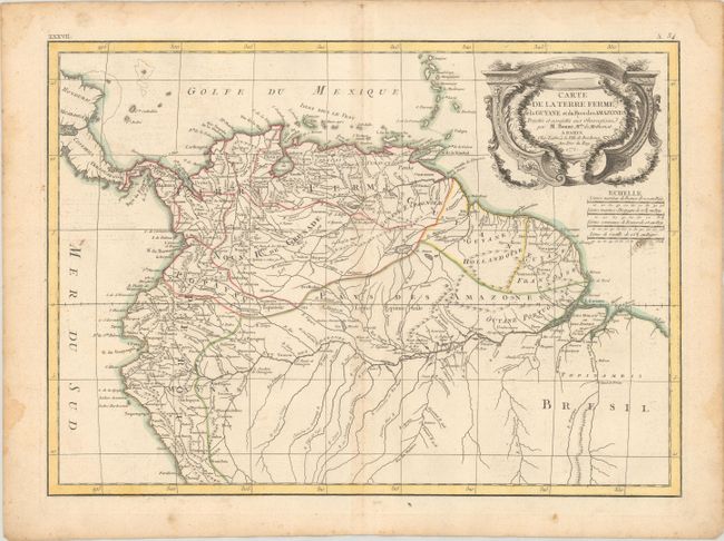
This uncommon and finely engraved map covers the region known as Tierra Firma (Columbia and Venezuela), the Dutch, Portuguese, and French colonies of Guyana, and parts of Peru and Brazil. The region labeled Pays des Amazones shows a particularly well delineated Amazon River. One of the most interesting features on the map is Bonne's inclusion of the apocryphal Lake Parima that was first described by Walter Raleigh in the 16th century. The map is filled with information on the various tribes and locates some mines in addition to many place names.
References:
Condition: B+
Contemporary outline color on a watermarked sheet with light soiling, minor toning along the centerfold, and a couple of tiny holes in the image. There are damp stains confined to the edges of the sheet.