Subject: Southwestern United States & Mexico
Period: 1851 (dated)
Publication:
Color: Black & White
After the Treaty of Guadeloupe Hidalgo ended the war with Mexico in 1848, it was necessary to establish a boundary acceptable to both parties. The Mexican Boundary Survey was the result.
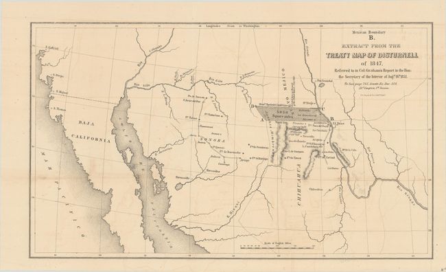
A. Mexican Boundary B. Extract from the Treaty Map of Disturnell of 1847..., from Sen. Ex. Doc. 119, 32nd Congress, 1st Session (15.5 x 9.1"). This map depicts a large shaded region in dispute as a result of a major error in the Disturnell map referenced in the Treaty of Guadalupe Hidalgo. The error was discovered when the American commissioner (John Russell Bartlett) and Mexican commissioner (General Pedro Garcia Conde) began the actual survey work for the southern boundary. Specifically, they discovered that Disturnell's map put the Rio Grande two degrees too far to the west and El Paso was placed about 30 miles too far north. The resulting 5,950 square mile error became a major political and economic issue for both sides, with . The land itself was rich in minerals and, for the United States, was the only practical route for a southern transcontinental railroad. The issue was eventually resolved by the inclusion of the disputed area in the Gadsden Purchase, whereby the United States took over this disputed territory (along with other lands) in exchange for a cash payment. Ref: Wheat (TMW) #718; Martin & Martin, plt #40.
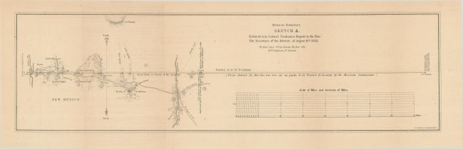
B. Mexican Boundary Sketch A..., from Sen. Ex. Doc. 121, 32nd Congress, 1st Session (18.6 x 5.1"). This small map covers the southern border of New Mexico from the Rio Grande to the Rio Mimbres. Wheat notes that it was "“a curiously oriented map with south at the top…showing the survey as it was progressing when interrupted by Gray.” Ref: Wheat (TMW) #717.
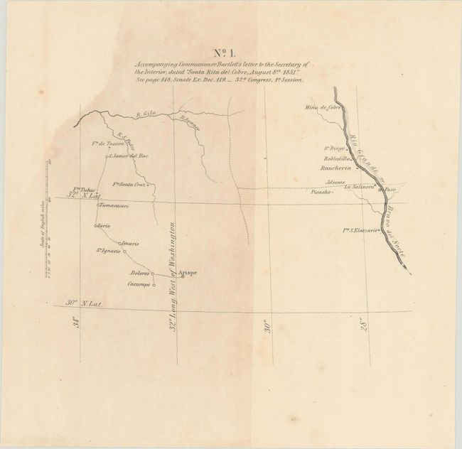
C. No. 1. Accompanying Commissioner Bartlett’s Letter to the Secretary of the Interior, Dated “Santa Rita del Cobre, August 8th 1851," from Sen. Ex. Doc. 119, 32nd Congress, 1st Session (6.9 x 5.6"). A small map showing the disputed region west of the Rio Grande to the 34th meridian from Washington D.C. Ref: Wheat (TMW) #705.
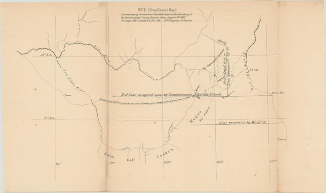
D. No. 2 (From Emory’s Map) Accompanying Commissioner Bartlett’s Letter to the Secretary of the Interior Dated “Santa Rita del Cobre, August 8th 1851,” from Sen. Ex. Doc. 119, 32nd Congress, 1st Session, (12.1 x 7.8"). Presents the different boundaries proposed by Bartlett and Gray in the disputed region. Ref: Wheat (TMW) #704.
References:
Condition: B+
Issued folding with some light toning and faint offsetting.