Subject: Southwestern United States & Mexico, Texas
Period: 1842 (dated)
Publication: The London Atlas of Universal Geography
Color: Hand Color
Size:
23.6 x 18.9 inches
59.9 x 48 cm
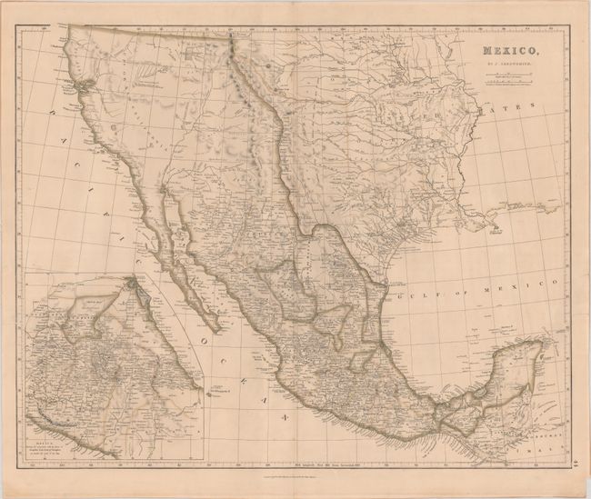
This edition of Arrowsmith's southwestern United States, Texas and Mexico shows the Independent Republic of Texas in a stovepipe configuration, with the southern border along the Rio Grande (R. Bravo del Norte). The northern border now follows the 100th parallel to the Arkansas River. In Upr. or New California, there is an American Fur Co. Depot on the eastern shore of Youta or Gt. Salt L.. In New Mexico, the Great Spanish Road is shown from the Red River on the Texas boundary to Santa Fe, and then heading south through the length of Mexico. A large inset depicts central Mexico, centered on Mexico City and showing the important ports of Acapulco, Vera Cruz and Tampico. Although the map is dated 1842, the Texas borders reflect a date circa 1844.
References:
Condition: B+
Contemporary outline color with several short edge tears (two of which just enter the map border) that have been closed on verso with tape.