Subject: Southern United States, Mexico & Central America
Period: 1831 (circa)
Publication: Lizar's Edinburgh Geographical General Atlas...
Color: Hand Color
Size:
19.3 x 16.5 inches
49 x 41.9 cm
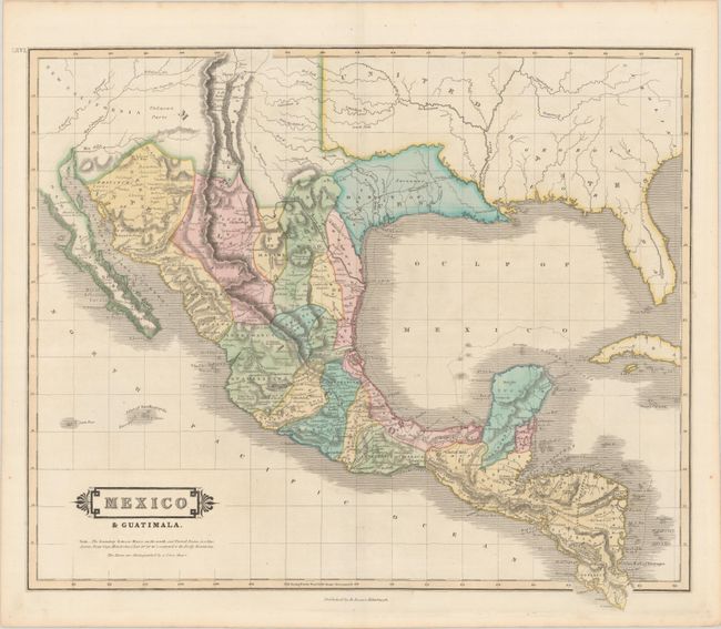
This handsome map focuses on Mexico and Central America, although it also covers most of the southern United States as well with good detail in New Mexico and Texas, which at the time were parts of Mexico. Mexico is divided into the Intendancies, and Guatemala takes in all of Central America except for the British colony of Belize. New Mexico is shown as a narrow strip of land along the upper Rio Grande River, and most of New California is noted at Unknown Parts. The roads (El Camino Real) connecting Natchitoches and Santa Fe with Mexico City are prominently delineated. Numerous mines are located with small crosses.
References: Kapp (MCC-106) #114.
Condition: A+
A fine example in contemporary color.