Subject: Texas
Period: 1855 (dated)
Publication:
Color: Hand Color
Size:
25.9 x 16.6 inches
65.8 x 42.2 cm
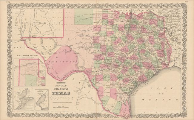
This double-page map shows extensive detail throughout the settled part of the state. The western third is comprised of the large unsettled areas of Presidio, El Paso, Bexar and the Staked Plain. Locates railroads, forts, post offices, roads, springs, and topographical detail. Includes three inset maps: Plan of the Northern Part of Texas, Plan of Galveston Bay from the U.S. Coast Survey, and Plan of Sabine Lake. Surrounded by Colton's decorative scroll borders. Published by G.W. and C.B. Colton. Dated 1855 but the appearance of the newly established Coleman County indicates a publication date of circa 1864.
References:
Condition: A
Contemporary color with some minor scattered foxing and faint toning along the centerfold.