Subject: Portland, Oregon
Period: 1921 (dated)
Publication:
Color: Printed Color
Size:
48.3 x 21.8 inches
122.7 x 55.4 cm
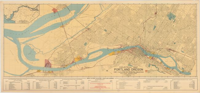
A detailed map of the Portland region extending to Vancouver, Washington and showing the street grid pattern of city. Published by the Commission of Public Docks with a color-coded key identifying public docks property, shipyards and dry docks, lumber mills, railroads, and street car lines. Includes an inset of "Portland to the Sea" at top left and an index to port facilities at bottom. The Commission of Public Docks was founded by the city in 1910 and merged with the Port of Portland (founded by the Oregon Legislature in 1892) in 1970. There are no past sales records or institutional examples located on OCLC for this edition.
References:
Condition: A
On a clean sheet with one small rust spot and a couple of short edge tears confined to the bottom blank margin that have been closed on verso with archival tape.