Subject: Massachusetts
Period: 1796 (published)
Publication: The American Universal Geography
Color: Black & White
Size:
9.7 x 7.4 inches
24.6 x 18.8 cm
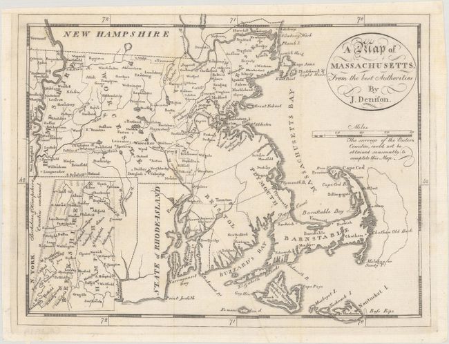
This uncommon map is from the third edition of Morse's Geography. Counties are named and delineated, and the bank offshore from Cape Cod is located. The western counties of Hampshire and Berkshire are continued in an inset at lower left. The map also shows towns, roads, topography, and good watershed detail. The Proposed Canal is located near Sandwich. Beneath the oval title cartouche and distance scale is the note "The surveys of the Eastern Counties, could not be obtained reasonably to complete this Map." As a result the counties of Bristol, Plymouth, and Barnstable are mostly blank. Drawn by James Denison and engraved by Samuel Hill.
References: McCorkle (18th C. Geography Books) #304-5; Wheat & Brun #218.
Condition: A
A nice impression on a clean sheet that has been professionally remargined at top. There is a small repaired edge tear in the bottom blank margin that just enters the map image.