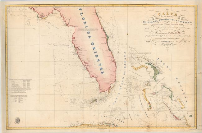
Subject: Florida & Bahamas
Period: 1838 (dated)
Publication:
Color: Hand Color
Size:
33.6 x 21.9 inches
85.3 x 55.6 cm
This Spanish chart of Florida and vicinity extends from St. Augustine south to the Florida Keys and northern Cuba, and from Saint Andrew Bay east to the Bahamas. Includes remarkable detail of coastal features, soundings, navigational hazards, currents, notations, and more. Features excellent detail of the Florida Keys and the islands just off of Cuba. The chart also delineates many of the routes used in preparation of the chart. Drawn by Jose Espejo and engraved by Manuel Giraldos. With the Direccion Hidrografica stamp at bottom left. Spanish sea charts are rare on the market.
References:
Condition: B
Backed with heavy linen to reinforce and repair several short edge tears that extend 1-3" into the images. There are a few chips at right with minor facsimile work that have been archivally repaired including in the ocean adjacent to San Salvador Island, next to the Bahama Banks, and in the flourishes of the title at bottom right. Light soiling and creasing throughout.