Subject: Connecticut
Period: 1796 (circa)
Publication: American Atlas
Color: Black & White
Size:
17.2 x 13.9 inches
43.7 x 35.3 cm
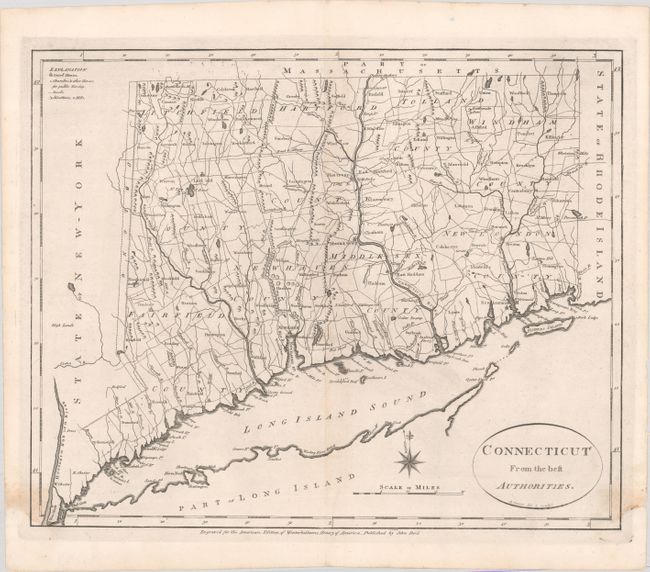
This early and uncommon map of Connecticut was engraved by Benjamin Tanner and included in both Winterbothom's History of America and the American Atlas, both published in 1796. Based on Amos Doolittle's map of the previous year, it shows the Oblong, an area of dispute between Connecticut and New York. The boundary line is shown following the Byram River from Long Island Sound to a point in line with the 3 Trees that were used as an early boundary marker. The map is finely detailed showing counties, topography, towns, churches, courthouses, and roads.
References: McCorkle #C796.4; Wheat & Brun #288; Phillips (Atlases) #1216-9.
Condition: B+
A nice impression with light stains at bottom left and bottom right and minor toning along the centerfold. Very nearly an "A" example.