Subject: Colorado
Period: 1881 (dated)
Publication:
Color: Hand Color
Size:
24.6 x 16.1 inches
62.5 x 40.9 cm
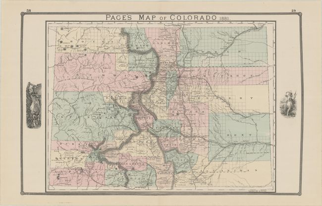
This uncommon early edition map of the state shows early county development including the immense counties of Arapahoe, Elbert, Bent, Weld and Las Animas in the eastern plains. Several railroads are shown including a branch of the Denver & Rio Grande that extends to Florida in La Plata County. Page made regular updates to this map as the 1886 edition would show an extension of this railroad to include Silverton and Howardsville (a line that was proposed but never actually built). The map locates many towns and mines and provides an excellent view of the topography. Some uncommon place names appear including Tennessee Colony near Ft. Morgan and Greeley. This early edition includes a mining vignette and has a blank verso.
References:
Condition: A+
A fine example on a clean sheet.