Catalog Archive
Auction 181, Lot 230

"Map of Territory Annexed to the City of Los Angeles California",

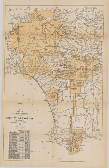
Subject: Los Angeles, California

Period: 1922 (dated)

Publication:

Color: Printed Color

Size:
15.4 x 24 inches
39.1 x 61 cm
Download High Resolution Image
(or just click on image to launch the Zoom viewer)

A scarce map of the Los Angeles region that depicts the then-present boundaries of the city. It delineates the original square boundary of the city as of 1850 with the numerous additions/consolidations radiating both south and west. A table at bottom left shows the annexation history. Compiled by John A. Griffin, City Engineer. No past sales record located for this 1922 edition and no institutional listings found on OCLC.

References:

Condition: B+

Issued folding with light toning along the fold lines and sheet edges.

Estimate: $200 - $230

Sold for: $250

Closed on 2/10/2021

Archived