Subject: Arizona
Period: 1896-1902 (circa)
Publication:
Color:
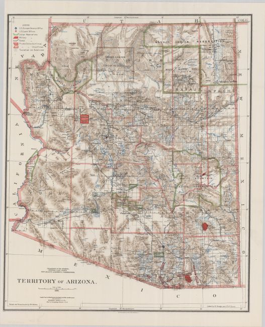
A. Territory of Arizona, by General Land Office, dated 1896, printed color (16.8 x 20.2"). This beautifully colored and highly detailed map shows the extent of nine Indian reservations and at least four military reservations including Fort Apache. Indian reservations are outlined in green, military reservations are shown in solid red, and private claims, confirmed and unconfirmed, outlined in red. The Grand Canyon Reserve is shown. The brown hachured mountain areas and the blue waterways combine to provide great visual impact. Information includes watershed, mountains, railroads, wagon roads, private claims, unsurveyed townships, etc. The Hopi reservation is still called the "Moqui" reservation. This edition was revised and reconstructed by R.H. Morton. A very handsome and historical map.
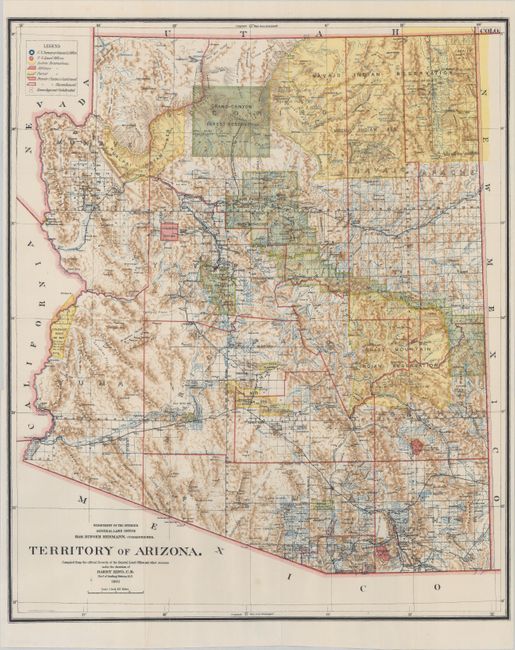
B. Territory of Arizona, by General Land Office, dated 1901, printed color (16.8 x 20.2"). An updated version of the map above issued 5 years later. Indian reservations are now shaded in yellow and Indian Reservations in green. Published just 11 years prior to statehood. Compiled by Henry King under the direction of Hon. Binger Hermann.
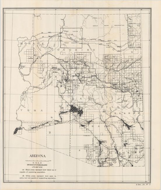
C. Arizona, by U.S. Geological Survey (USGS), from Sen. Ex. Doc. 36, 57th Congress, 2nd Session, circa 1902, black & white (18.4 x 21.6"). This uncommon map accompanied the 1902 Congressional report on preparations for Arizona statehood and shows areas that could and could not support population with the vast majority of Arizona deemed “open to entry" but not capable of supporting population.
References:
Condition: A+
All three maps are clean, bright, and fine. Issued folding.